
 Bel-Ha
San Jose El Alto
El Porvenir
Nueva Palestina
Santa Lucía
Chemax
La Morita
Temoac
Zacualpan
Bel-Ha
San Jose El Alto
El Porvenir
Nueva Palestina
Santa Lucía
Chemax
La Morita
Temoac
Zacualpan
Tastavins (Tastavins, vinos y tapas) on the map, Oaxaca, Mexico
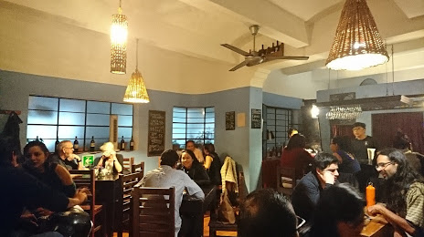
Photo
Where is located Tastavins (Tastavins, vinos y tapas)
Tastavins (Tastavins, vinos y tapas) — local attraction, which is located at Murguía 309, RUTA INDEPENDENCIA, Centro, 68000 Oaxaca de Juárez, Oax., Mexico and belongs to the category — $$. Average visitor rating for this place — 4.5 (according to 402 ratings, information from open sources and relevant for 2022).
Exact location — Tastavins (Tastavins, vinos y tapas), marked on the map with a red marker.
You can get directions to Tastavins (Tastavins, vinos y tapas) on the map from your location.
What else is interesting in Oaxaca? You can see all the sights if you go to the city page.
Coordinates
Tastavins (Tastavins, vinos y tapas), Mexico coordinates in decimal format: latitude — 17.063259292316886, longitude — -96.72164719289397. When converted to degrees, minutes, seconds Tastavins (Tastavins, vinos y tapas) has the following coordinates: 17°3′47.73 north latitude and -96°43′17.93 east longitude.
Nearby cities
The largest cities that are located nearby:
- Tehuacán — 171 km
- Orizaba — 202 km
- Córdoba — 203 km
- Minatitlán — 250 km
- Coatzacoalcos — 266 km
- Puebla — 268 km
- Xalapa — 275 km
- Chilpancingo — 298 km
- Cuautla — 304 km
- Jiutepec — 327 km
- Iguala — 328 km
- Cuernavaca — 333 km
- Chalco de Díaz Covarrubias — 333 km
- Martínez de la Torre — 334 km
- Acapulco — 335 km
- Ixtapaluca — 335 km
- Ciudad Nezahualcóyotl — 351 km
- Chimalhuacan — 351 km
- Texcoco — 352 km
Distance to the capital
Distance to the capital (Mexico City) is about — 367 km.