
 Bel-Ha
San Jose El Alto
El Porvenir
Nueva Palestina
Santa Lucía
Chemax
La Morita
Temoac
Zacualpan
Bel-Ha
San Jose El Alto
El Porvenir
Nueva Palestina
Santa Lucía
Chemax
La Morita
Temoac
Zacualpan
UPAEP- Museo (Museo UPAEP) on the map, Puebla, Mexico
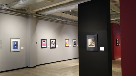
Photo
Where is located UPAEP- Museo (Museo UPAEP)
UPAEP- Museo (Museo UPAEP) — local attraction, which is located at Av 11 Pte 1916, Barrio de Santiago, 72410 Puebla, Pue., Mexico and belongs to the category — museum. Average visitor rating for this place — 4.5 (according to 173 ratings, information from open sources and relevant for 2022).
Exact location — UPAEP- Museo (Museo UPAEP), marked on the map with a red marker.
You can get directions to UPAEP- Museo (Museo UPAEP) on the map from your location.
What else is interesting in Puebla? You can see all the sights if you go to the city page.
Coordinates
UPAEP- Museo (Museo UPAEP), Mexico coordinates in decimal format: latitude — 19.04816229750203, longitude — -98.21575969286508. When converted to degrees, minutes, seconds UPAEP- Museo (Museo UPAEP) has the following coordinates: 19°2′53.38 north latitude and -98°12′56.73 east longitude.
Nearby cities
The largest cities that are located nearby:
- Ixtapaluca — 76 km
- Chalco de Díaz Covarrubias — 76 km
- Cuautla — 82 km
- Texcoco — 87 km
- Chimalhuacan — 89 km
- Ciudad Nezahualcóyotl — 91 km
- Jiutepec — 104 km
- Tehuacán — 106 km
- Cuernavaca — 107 km
- Ecatepec — 108 km
- Ojo de Agua — 111 km
- Coacalco — 114 km
- Tlalnepantla — 116 km
- Tulancingo — 116 km
- Orizaba — 117 km
- Naucalpan — 118 km
- Buenavista — 118 km
- Ciudad López Mateos — 124 km
- Cuautitlán Izcalli — 128 km
Distance to the capital
Distance to the capital (Mexico City) is about — 105 km.