
 Józefów nad Wisłą
Gorzyce Wielkie
Rogówek
Sromowce Niżne
Wyszków County
Kruszewo
Jantar
Sady Górne
Nagoszewo
Józefów nad Wisłą
Gorzyce Wielkie
Rogówek
Sromowce Niżne
Wyszków County
Kruszewo
Jantar
Sady Górne
Nagoszewo
Pier in Sopot (Molo w Sopocie) on the map, Gdańsk, Poland
Photo
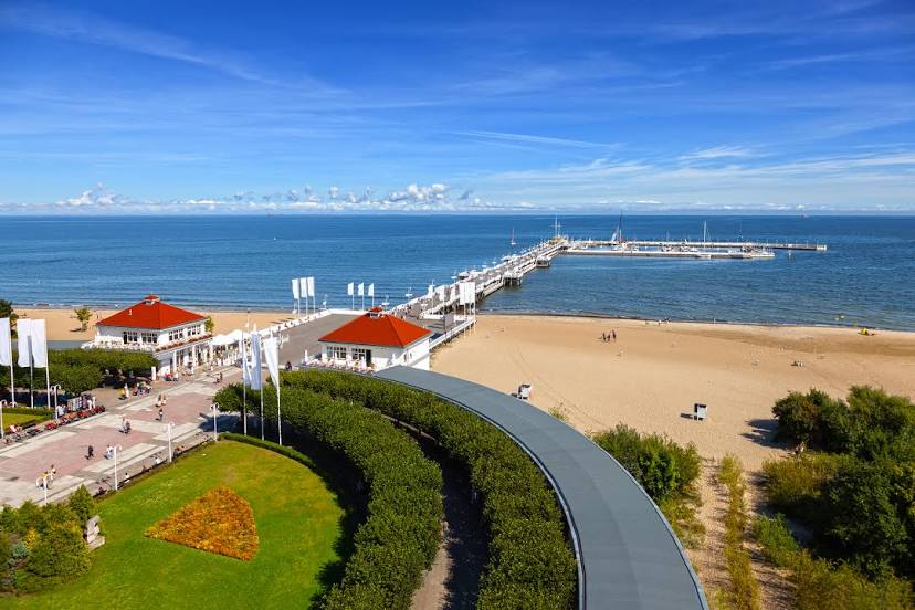
Where is located Pier in Sopot (Molo w Sopocie)
Pier in Sopot (Molo w Sopocie) — local attraction, which is located at Plac Zdrojowy 2, 81-723 Sopot, Poland and belongs to the category — pier. Average visitor rating for this place — 4.5 (according to 81571 rating, information from open sources and relevant for 2022).
Exact location — Pier in Sopot (Molo w Sopocie), marked on the map with a red marker.
You can get directions to Pier in Sopot (Molo w Sopocie) on the map from your location.
What else is interesting in Gdańsk? You can see all the sights if you go to the city page.
Coordinates
Pier in Sopot (Molo w Sopocie), Poland coordinates in decimal format: latitude — 54.446959411798794, longitude — 18.573313908114446. When converted to degrees, minutes, seconds Pier in Sopot (Molo w Sopocie) has the following coordinates: 54°26′49.05 north latitude and 18°34′23.93 east longitude.
Nearby cities
The largest cities that are located nearby:
- Gdynia — 20 km
- Elblag — 54 km
- Kaliningrad
 (Russia) — 126 km
 - Olsztyn — 136 km
- Bydgoszcz — 142 km
- Torun — 148 km
- Koszalin — 161 km
- Wloclawek — 190 km
- Plock — 212 km
- Klaipėda
 (Lithuania) — 216 km
 - Poznań — 244 km
- Kalisz — 288 km
- Szczecin — 288 km
- Gorzów Wielkopolski — 290 km
- Łódź — 292 km
- Bialystok — 329 km
- Šiauliai (Lithuania) — 338 km
- Kaunas (Lithuania) — 340 km
- Zielona Gora — 342 km
Distance to the capital
Distance to the capital (Warsaw) is about — 295 km.