
 Gilserberg
Berlin
Bordesholm
Bechtolsheim
Aub
Triptis
Heppenheim
Biblis
Angermünde
Gilserberg
Berlin
Bordesholm
Bechtolsheim
Aub
Triptis
Heppenheim
Biblis
Angermünde
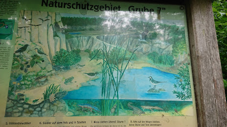
Grube 7 und ehemaliger Klärteich on the map, Wuppertal, Germany
Photo
Where is located Grube 7 und ehemaliger Klärteich
Grube 7 und ehemaliger Klärteich — local attraction, which is located at 42781 Haan, Germany and belongs to the category — nature preserve. Average visitor rating for this place — 4.5 (according to 419 ratings, information from open sources and relevant for 2022).
Exact location — Grube 7 und ehemaliger Klärteich, marked on the map with a red marker.
You can get directions to Grube 7 und ehemaliger Klärteich on the map from your location.
What else is interesting in Wuppertal? You can see all the sights if you go to the city page.
Coordinates
Grube 7 und ehemaliger Klärteich, Germany coordinates in decimal format: latitude — 51.23264591604791, longitude — 7.019105107943698. When converted to degrees, minutes, seconds Grube 7 und ehemaliger Klärteich has the following coordinates: 51°13′57.53 north latitude and 7°1′8.78 east longitude.
Nearby cities
The largest cities that are located nearby:
- Remscheid — 9 km
- Solingen — 11 km
- Essen — 24 km
- Hagen — 25 km
- Witten — 25 km
- Bochum — 25 km
- Mülheim — 26 km
- Düsseldorf — 26 km
- Bergisch Gladbach — 29 km
- Gelsenkirchen — 29 km
- Herne — 31 km
- Neuss — 33 km
- Oberhausen — 33 km
- Duisburg — 33 km
- Bottrop — 33 km
- Dortmund — 36 km
- Cologne — 38 km
- Recklinghausen — 40 km
- Krefeld — 40 km
Distance to the capital
Distance to the capital (Berlin) is about — 461 km.