
 Gilserberg
Berlin
Bordesholm
Bechtolsheim
Aub
Triptis
Heppenheim
Biblis
Angermünde
Gilserberg
Berlin
Bordesholm
Bechtolsheim
Aub
Triptis
Heppenheim
Biblis
Angermünde
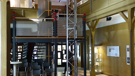
Deutsches Verpackungs-Museum on the map, Heidelberg, Germany
Photo
Where is located Deutsches Verpackungs-Museum
Deutsches Verpackungs-Museum — local attraction, which is located at Hauptstraße 22, 69117 Heidelberg, Germany and belongs to the category — museum. Average visitor rating for this place — 4.2 (according to 124 ratings, information from open sources and relevant for 2022).
Exact location — Deutsches Verpackungs-Museum, marked on the map with a red marker.
You can get directions to Deutsches Verpackungs-Museum on the map from your location.
What else is interesting in Heidelberg? You can see all the sights if you go to the city page.
Coordinates
Deutsches Verpackungs-Museum, Germany coordinates in decimal format: latitude — 49.409565575366194, longitude — 8.694541628077134. When converted to degrees, minutes, seconds Deutsches Verpackungs-Museum has the following coordinates: 49°24′34.44 north latitude and 8°41′40.35 east longitude.
Nearby cities
The largest cities that are located nearby:
- Mannheim — 18 km
- Ludwigshafen — 18 km
- Karlsruhe — 48 km
- Heilbronn — 48 km
- Darmstadt — 52 km
- Pforzheim — 56 km
- Mainz — 72 km
- Offenbach — 77 km
- Stuttgart — 78 km
- Frankfurt — 79 km
- Wiesbaden — 81 km
- Würzburg — 101 km
- Reutlingen — 106 km
- Strasbourg
 (France) — 113 km
 - Saarbrücken — 122 km
- Koblenz — 131 km
- Ulm — 147 km
- Trier — 150 km
- Freiburg — 167 km
Distance to the capital
Distance to the capital (Berlin) is about — 478 km.