
 Gilserberg
Berlin
Bordesholm
Bechtolsheim
Aub
Triptis
Heppenheim
Biblis
Angermünde
Gilserberg
Berlin
Bordesholm
Bechtolsheim
Aub
Triptis
Heppenheim
Biblis
Angermünde
DreiLänderGarten on the map, Weil am Rhein, Germany
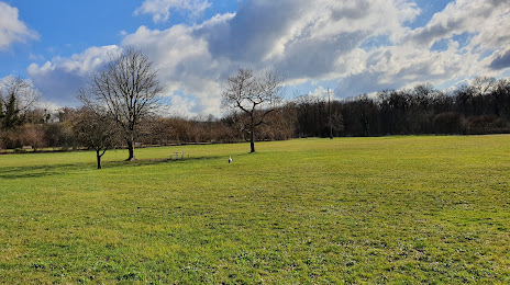
Photo
Where is located DreiLänderGarten
DreiLänderGarten — local attraction, which is located at Basler Str. 45, 79576 Weil am Rhein, Germany and belongs to the category — state park. Average visitor rating for this place — 4.4 (according to 384 ratings, information from open sources and relevant for 2022).
Exact location — DreiLänderGarten, marked on the map with a red marker.
You can get directions to DreiLänderGarten on the map from your location.
What else is interesting in Weil am Rhein? You can see all the sights if you go to the city page.
Coordinates
DreiLänderGarten, Germany coordinates in decimal format: latitude — 47.58638772467585, longitude — 7.608305807863987. When converted to degrees, minutes, seconds DreiLänderGarten has the following coordinates: 47°35′11 north latitude and 7°36′29.9 east longitude.
Nearby cities
The largest cities that are located nearby:
- Basel
 (Switzerland) — 3 km
 - Mulhouse
 (France) — 27 km
 - Freiburg — 48 km
- Bern (Switzerland) — 73 km
- Zurich (Switzerland) — 73 km
- Strasbourg (France) — 109 km
- Besançon (France) — 126 km
- Lausanne (Switzerland) — 140 km
- Reutlingen — 154 km
- Nancy (France) — 160 km
- Pforzheim — 163 km
- Karlsruhe — 166 km
- Stuttgart — 173 km
- Saarbrücken — 188 km
- Geneva (Switzerland) — 191 km
- Ulm — 195 km
- Dijon (France) — 196 km
- Metz (France) — 198 km
- Heilbronn — 206 km
Distance to the capital
Distance to the capital (Berlin) is about — 687 km.