
 Belém
Maranguape
Paranaguá
Paranaguá
Monte Alegre
Alvorada de Minas
Bragança
Laguna
Ibiporã
Belém
Maranguape
Paranaguá
Paranaguá
Monte Alegre
Alvorada de Minas
Bragança
Laguna
Ibiporã
Igreja de São Pedro on the map, Fortaleza, Brazil
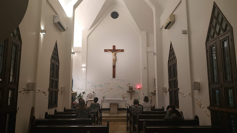
Photo
Where is located Igreja de São Pedro
Igreja de São Pedro — local attraction, which is located at 1149, Av. Almirante Barroso, 1091 - Praia de Iracema, Fortaleza - CE, 60060-440, Brazil and belongs to the category — catholic church. Average visitor rating for this place — 4.7 (according to 164 ratings, information from open sources and relevant for 2022).
Exact location — Igreja de São Pedro, marked on the map with a red marker.
You can get directions to Igreja de São Pedro on the map from your location.
What else is interesting in Fortaleza? You can see all the sights if you go to the city page.
Coordinates
Igreja de São Pedro, Brazil coordinates in decimal format: latitude — -3.752274716880581, longitude — -38.55026755643959. When converted to degrees, minutes, seconds Igreja de São Pedro has the following coordinates: -3°45′8.19 north latitude and -38°33′0.96 east longitude.
Nearby cities
The largest cities that are located nearby:
- Caucaia — 15 km
- Maracanaú — 19 km
- Mossoro — 206 km
- Parnaíba — 370 km
- Juazeiro do Norte — 396 km
- Natal — 430 km
- Parnamirim — 432 km
- Campina Grande — 483 km
- Teresina — 494 km
- Timon — 498 km
- Santa Rita — 542 km
- Caxias — 547 km
- João Pessoa — 551 km
- Caruaru — 576 km
- Camaragibe — 613 km
- Recife — 623 km
- Jaboatão dos Guararapes — 625 km
- São Luís — 649 km
- Petrolina — 662 km