
 Puerto de la Duquesa
La Serna de Iguña
Pumalverde
Puentenansa
La Iglesia
Casar de Periedo
Fuengirola
Renedo de Piélagos
Villabanez
Puerto de la Duquesa
La Serna de Iguña
Pumalverde
Puentenansa
La Iglesia
Casar de Periedo
Fuengirola
Renedo de Piélagos
Villabanez
Parque del Agua Luis Buñuel on the map, Zaragoza, Spain
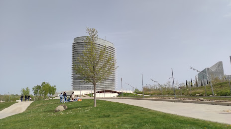
Photo
Where is located Parque del Agua Luis Buñuel
Parque del Agua Luis Buñuel — local attraction, which is located at P.º de los Puentes, 2, 50018 Zaragoza, Spain and belongs to the category — park. Average visitor rating for this place — 4.5 (according to 3051 rating, information from open sources and relevant for 2022).
Exact location — Parque del Agua Luis Buñuel, marked on the map with a red marker.
You can get directions to Parque del Agua Luis Buñuel on the map from your location.
What else is interesting in Zaragoza? You can see all the sights if you go to the city page.
Coordinates
Parque del Agua Luis Buñuel, Spain coordinates in decimal format: latitude — 41.66921277851706, longitude — -0.9126082923312235. When converted to degrees, minutes, seconds Parque del Agua Luis Buñuel has the following coordinates: 41°40′9.17 north latitude and -0°54′45.39 east longitude.
Nearby cities
The largest cities that are located nearby:
- Lleida — 125 km
- Pamplona — 143 km
- Logroño — 156 km
- Tarragona — 187 km
- Vitoria-Gasteiz — 198 km
- San Sebastián — 204 km
- Terrassa — 240 km
- Burgos — 242 km
- Bilbao — 243 km
- Alcala de Henares — 245 km
- Valencia — 245 km
- Sabadell — 248 km
- L'Hospitalet de Llobregat — 251 km
- Torrejón de Ardoz — 254 km
- Santa Coloma de Gramenet — 258 km
- Badalona — 261 km
- Alcobendas — 262 km
- Mataró — 276 km
- Getafe — 282 km
Distance to the capital
Distance to the capital (Madrid) is about — 272 km.