Bom Jesus dos Perdões — Nova Lacerda
Bom Jesus dos Perdões — Santa Cruz da Conceição
Bom Jesus dos Perdões — Tabatinga
Bom Jesus dos Perdões — Francisco Alves
Bom Jesus dos Perdões — São Manuel
Bom Jesus dos Perdões — Nova Londrina
Bom Jesus dos Perdões — Ribeirão das Neves
Bom Jesus dos Perdões — Macucos
Bom Jesus dos Perdões — Tijucas
Bom Jesus dos Perdões — Ituverava
Bom Jesus dos Perdões — São Lourenço da Serra
Bom Jesus dos Perdões — Green Hill
Bom Jesus dos Perdões — Mirinzal
Bom Jesus dos Perdões — Lagoa Grande
Bom Jesus dos Perdões — Irará
Bom Jesus dos Perdões — Taió
Bom Jesus dos Perdões — Ijuí
Bom Jesus dos Perdões — Ibaté
Bom Jesus dos Perdões — São José do Norte
Igaratá
Jacareí
São José dos Campos
Aeroporto Internacional de São José dos Campos - Professor Urbano Ernesto
Caçapava
Caçapava
Taubaté
Tremembé
Pindamonhangaba
Roseira
Aparecida
Guaratinguetá
Lorena
Canas
Cachoeira Paulista
Cruzeiro
Lavrinhas
Queluz
Itatiaia
Penedo
Resende
Porto Real
Quatis
Aeroporto de Juiz de Fora
Matias Barbosa
Juiz de Fora
Bom Jesus dos Perdões — Nova Lacerda
Bom Jesus dos Perdões — Santa Cruz da Conceição
Bom Jesus dos Perdões — Tabatinga
Bom Jesus dos Perdões — Francisco Alves
Bom Jesus dos Perdões — São Manuel
Bom Jesus dos Perdões — Nova Londrina
Bom Jesus dos Perdões — Ribeirão das Neves
Bom Jesus dos Perdões — Macucos
Bom Jesus dos Perdões — Tijucas
Bom Jesus dos Perdões — Ituverava
Bom Jesus dos Perdões — São Lourenço da Serra
Bom Jesus dos Perdões — Green Hill
Bom Jesus dos Perdões — Mirinzal
Bom Jesus dos Perdões — Lagoa Grande
Bom Jesus dos Perdões — Irará
Bom Jesus dos Perdões — Taió
Bom Jesus dos Perdões — Ijuí
Bom Jesus dos Perdões — Ibaté
Bom Jesus dos Perdões — São José do Norte
Igaratá
Jacareí
São José dos Campos
Aeroporto Internacional de São José dos Campos - Professor Urbano Ernesto
Caçapava
Caçapava
Taubaté
Tremembé
Pindamonhangaba
Roseira
Aparecida
Guaratinguetá
Lorena
Canas
Cachoeira Paulista
Cruzeiro
Lavrinhas
Queluz
Itatiaia
Penedo
Resende
Porto Real
Quatis
Aeroporto de Juiz de Fora
Matias Barbosa
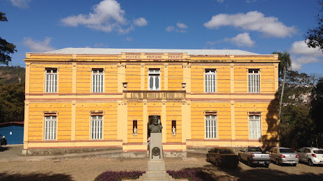
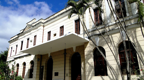
Juiz de Fora
Bom Jesus dos Perdões — Juiz de Fora distance, route on the map
Distance by car
Distance between Bom Jesus dos Perdões, State of São Paulo, Brazil and Juiz de Fora, Minas Gerais, Brazil by car is — km, or miles. To travel this distance by car, you need minute, or h.
Route on the map, driving directions
Car route Bom Jesus dos Perdões — Juiz de Fora was created automatically. The road on the map is shown as a blue line. By moving the markers, you can create a new route through the points you need.
Passing cities through which the car route passes: Nazaré Paulista, Igaratá, Jacareí, São José dos Campos, Aeroporto Internacional de São José dos Campos - Professor Urbano Ernesto, Caçapava, Caçapava, Taubaté, Tremembé, Pindamonhangaba, Roseira, Aparecida, Guaratinguetá, Lorena, Canas, Cachoeira Paulista, Cruzeiro, Lavrinhas, Queluz, Itatiaia, Penedo, Resende, Porto Real, Quatis, Aeroporto de Juiz de Fora, Matias Barbosa, Juiz de Fora.
Distance by plane
If you decide to take a trip Bom Jesus dos Perdões Juiz de Fora by plane, then you have to fly the distance — 356 km or 221 miles. It is marked on the map with a gray line (between two points in a straight line).
Flight time
Estimated flight time Bom Jesus dos Perdões Juiz de Fora by plane at cruising speed 750 km / h will be — 28 min.
Direction of movement
Brazil, Bom Jesus dos Perdões — right-hand traffic. Brazil, Juiz de Fora — right-hand traffic.
Difference in time
Bom Jesus dos Perdões and Juiz de Fora are in the same time zone. Between them there is no time difference (UTC -3 America/Sao_Paulo).
Interesting Facts
Information on alternative ways to get to your destination.
The length of this distance is about 0.9% of the total length of the equator.
The percentage of the population is clearly shown in the graph:
Bom Jesus dos Perdões — 12,422 (less by 457,779), Juiz de Fora — 470,201 residents.
The cost of travel
Calculate the cost of the trip yourself using the fuel consumption calculator, changing the data in the table.