
 Puerto de la Duquesa
La Serna de Iguña
Pumalverde
Puentenansa
La Iglesia
Casar de Periedo
Fuengirola
Renedo de Piélagos
Villabanez
Puerto de la Duquesa
La Serna de Iguña
Pumalverde
Puentenansa
La Iglesia
Casar de Periedo
Fuengirola
Renedo de Piélagos
Villabanez
King Alfonso II "El Casto" Chapel (Capilla del rey Casto) on the map, Oviedo, Spain
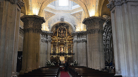
Photo
Where is located King Alfonso II "El Casto" Chapel (Capilla del rey Casto)
King Alfonso II "El Casto" Chapel (Capilla del rey Casto) — local attraction, which is located at C. del Águila, 1, 33003 Oviedo, Asturias, Spain and belongs to the category — chapel. Average visitor rating for this place — 4.6 (according to 15 ratings, information from open sources and relevant for 2022).
Exact location — King Alfonso II "El Casto" Chapel (Capilla del rey Casto), marked on the map with a red marker.
You can get directions to King Alfonso II "El Casto" Chapel (Capilla del rey Casto) on the map from your location.
What else is interesting in Oviedo? You can see all the sights if you go to the city page.
Coordinates
King Alfonso II "El Casto" Chapel (Capilla del rey Casto), Spain coordinates in decimal format: latitude — 43.36257087835662, longitude — -5.843783092277463. When converted to degrees, minutes, seconds King Alfonso II "El Casto" Chapel (Capilla del rey Casto) has the following coordinates: 43°21′45.26 north latitude and -5°50′37.62 east longitude.
Nearby cities
The largest cities that are located nearby:
- Gijón — 24 km
- León — 87 km
- Santander — 164 km
- Ourense — 200 km
- A Coruña — 206 km
- Burgos — 209 km
- Valladolid — 211 km
- Bilbao — 235 km
- Vitoria-Gasteiz — 263 km
- Salamanca — 265 km
- Vigo — 266 km
- Braga
 (Portugal) — 293 km
 - Logroño — 295 km
- San Sebastián — 311 km
- Porto (Portugal) — 336 km
- Pamplona — 346 km
- Alcobendas — 363 km
- Alcorcón — 374 km
- Móstoles — 375 km
Distance to the capital
Distance to the capital (Madrid) is about — 372 km.