
 La Ensenada
Obero
Cuilapa
Laguna de Montebello
Uaxactun
Melchor de Mencos
Petetan
El Subin
Patanatic
La Ensenada
Obero
Cuilapa
Laguna de Montebello
Uaxactun
Melchor de Mencos
Petetan
El Subin
Patanatic
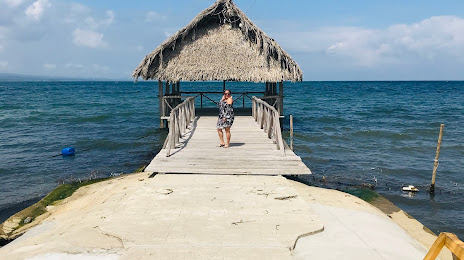
Playa Amatique Bay on the map, Puerto Barrios, Guatemala
Photo
Where is located Playa Amatique Bay
Playa Amatique Bay — local attraction, which is located at no data and belongs to the category — -. Average visitor rating for this place — 4.6 (according to 712 ratings, information from open sources and relevant for 2022).
Exact location — Playa Amatique Bay, marked on the map with a red marker.
You can get directions to Playa Amatique Bay on the map from your location.
What else is interesting in Puerto Barrios? You can see all the sights if you go to the city page.
Coordinates
Playa Amatique Bay, Guatemala coordinates in decimal format: latitude — 15.748088789112165, longitude — -88.58218068849078. When converted to degrees, minutes, seconds Playa Amatique Bay has the following coordinates: 15°44′53.12 north latitude and -88°34′55.85 east longitude.
Nearby cities
The largest cities that are located nearby:
- San Pedro Sula
 (Honduras) — 63 km
 - Choloma (Honduras) — 69 km
- El Progreso (Honduras) — 91 km
- La Ceiba (Honduras) — 186 km
- Santa Ana
 (El Salvador) — 219 km
 - Apopa (El Salvador) — 220 km
- Mejicanos (El Salvador) — 229 km
- Soyapango (El Salvador) — 230 km
- Tegucigalpa (Honduras) — 233 km
- San Salvador (El Salvador) — 234 km
- Santa Tecla (El Salvador) — 238 km
- San Juan Sacatepéquez — 246 km
- Villa Canales — 248 km
- San Miguel (El Salvador) — 251 km
- Villa Nueva — 252 km
- Escuintla — 283 km
- Chetumal
 (Mexico) — 309 km
 - Quetzaltenango — 328 km
- Chinandega
 (Nicaragua) — 376 km
Distance to the capital
Distance to the capital (Guatemala City) is about — 245 km.