
 Concepcion
Angostura
Belmira
Roldanillo
Zarzal
Guacarí
Dagua
Funza
Choachí
Jamundí
Quimbaya
Cota
Cartago
Bello
Canalete
Riosucio
Florencia
Cienaga
Alcantarilla
Concepcion
Angostura
Belmira
Roldanillo
Zarzal
Guacarí
Dagua
Funza
Choachí
Jamundí
Quimbaya
Cota
Cartago
Bello
Canalete
Riosucio
Florencia
Cienaga
Alcantarilla
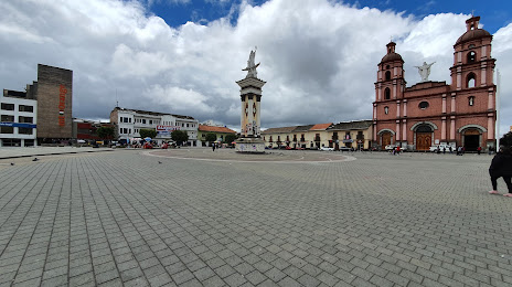
Ipiales on the map, Colombia
Where is located Ipiales
Exact location — Ipiales, Ipiales, Nariño, Colombia, marked on the map with a red marker.
Coordinates
Ipiales, Colombia coordinates in decimal format: latitude — 0.8264, longitude — -77.63946. When converted to degrees, minutes, seconds Ipiales has the following coordinates: 0°49′35.04 north latitude and -77°38′22.06 east longitude.
Population
Ipiales, Ipiales, Nariño, Colombia, according to our data the population is — 77,730 residents, which is about 0.2% of the total population of the country (Colombia).
Comparison of the population on the graph:
Exact time
Time zone for this location Ipiales — UTC -5 America/Bogota. Exact time — saturday, 4 april 2024 year, 17 h. 28 minutes.
Sunrise and sunset
Ipiales, sunrise and sunset data for a date — saturday 27.04.2024.
| Sunrise | Sunset | Day (duration) |
|---|---|---|
| 06:06 -0 minutes | 18:10 -0 minutes | 12 h. 6 minutes. -0 minutes |
You can control the scale of the map using the auxiliary tools to find out exactly where it is located Ipiales. When you change the scale of the map, the width of the ruler also changes (in kilometers and miles).
Nearby cities
The largest cities that are located nearby:
- Pasto — 59 km
- Ibarra
 (Ecuador) — 75 km
 - Quito (Ecuador) — 144 km
- Santo Domingo (Ecuador) — 207 km
- Popayán — 212 km
- Florencia — 240 km
- Ambato (Ecuador) — 253 km
- Quevedo (Ecuador) — 287 km
- Riobamba (Ecuador) — 297 km
- Cali — 314 km
- Palmira — 334 km
- Buenaventura — 344 km
- Neiva — 348 km
- Buga — 371 km
- Portoviejo (Ecuador) — 374 km
- Milagro (Ecuador) — 392 km
- Manta (Ecuador) — 393 km
- Tuluá — 394 km
- Guayaquil (Ecuador) — 416 km
Distance to neighboring capitals:
- Quito (Ecuador) — 145 km
- Panama
 (Panama) — 931 km
 - San Jose
 (Costa Rica) — 1239 km
 - Caracas
 (Venezuela) — 1601 km
 - Nuestra Señora de La Paz
 (Bolivia) — 2191 km
 - Georgetown
 (Guyana) — 2260 km
 - Asuncion
 (Paraguay) — 3617 km
 - Santiago
 (Chile) — 3881 km
 - Buenos Aires
 (Argentina) — 4422 km
 - Montevideo
 (Uruguay) — 4559 km
Attractions
Distance to the capital
Distance to the capital (Bogota) is about — 577 km.