
 Gilserberg
Berlin
Bordesholm
Bechtolsheim
Aub
Triptis
Heppenheim
Biblis
Angermünde
Gilserberg
Berlin
Bordesholm
Bechtolsheim
Aub
Triptis
Heppenheim
Biblis
Angermünde
Karl-Bauer-Park on the map, Regensburg, Germany
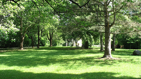
Photo
Where is located Karl-Bauer-Park
Karl-Bauer-Park — local attraction, which is located at Kumpfmühler Str. 52, 93051 Regensburg, Germany and belongs to the category — park. Average visitor rating for this place — 4.2 (according to 37 ratings, information from open sources and relevant for 2022).
Exact location — Karl-Bauer-Park, marked on the map with a red marker.
You can get directions to Karl-Bauer-Park on the map from your location.
What else is interesting in Regensburg? You can see all the sights if you go to the city page.
Coordinates
Karl-Bauer-Park, Germany coordinates in decimal format: latitude — 49.00673171473886, longitude — 12.08461980791379. When converted to degrees, minutes, seconds Karl-Bauer-Park has the following coordinates: 49°0′24.23 north latitude and 12°5′4.63 east longitude.
Nearby cities
The largest cities that are located nearby:
- Ingolstadt — 56 km
- Nuremberg — 88 km
- Fürth — 95 km
- Erlangen — 101 km
- Munich — 104 km
- Augsburg — 113 km
- Pilsen
 (Czech Republic) — 121 km
 - Salzburg
 (Austria) — 151 km
 - Ulm — 169 km
- Würzburg — 176 km
- Linz (Austria) — 179 km
- Innsbruck (Austria) — 200 km
- Prague (Czech Republic) — 203 km
- Gera — 207 km
- Chemnitz — 209 km
- Heilbronn — 210 km
- Stuttgart — 214 km
- Reutlingen — 220 km
- Erfurt — 230 km
Distance to the capital
Distance to the capital (Berlin) is about — 402 km.