
 Puerto de la Duquesa
La Serna de Iguña
Pumalverde
Puentenansa
La Iglesia
Casar de Periedo
Fuengirola
Renedo de Piélagos
Villabanez
Puerto de la Duquesa
La Serna de Iguña
Pumalverde
Puentenansa
La Iglesia
Casar de Periedo
Fuengirola
Renedo de Piélagos
Villabanez
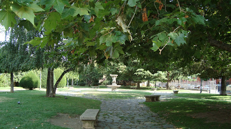
Parque Del Cid on the map, León, Spain
Photo
Where is located Parque Del Cid
Parque Del Cid — local attraction, which is located at Calle Cid, 15, 24003 León, Spain and belongs to the category — park. Average visitor rating for this place — 4.3 (according to 936 ratings, information from open sources and relevant for 2022).
Exact location — Parque Del Cid, marked on the map with a red marker.
You can get directions to Parque Del Cid on the map from your location.
What else is interesting in León? You can see all the sights if you go to the city page.
Coordinates
Parque Del Cid, Spain coordinates in decimal format: latitude — 42.59933779635473, longitude — -5.5706516923019125. When converted to degrees, minutes, seconds Parque Del Cid has the following coordinates: 42°35′57.62 north latitude and -5°34′14.35 east longitude.
Nearby cities
The largest cities that are located nearby:
- Oviedo — 87 km
- Gijón — 103 km
- Valladolid — 126 km
- Burgos — 155 km
- Santander — 170 km
- Salamanca — 180 km
- Ourense — 190 km
- Bilbao — 224 km
- Vitoria-Gasteiz — 236 km
- A Coruña — 244 km
- Logroño — 255 km
- Vigo — 261 km
- Braga
 (Portugal) — 264 km
 - Alcobendas — 280 km
- Alcorcón — 289 km
- Móstoles — 290 km
- Leganés — 293 km
- Torrejón de Ardoz — 295 km
- Fuenlabrada — 295 km
Distance to the capital
Distance to the capital (Madrid) is about — 288 km.