
 Bel-Ha
San Jose El Alto
El Porvenir
Nueva Palestina
Santa Lucía
Chemax
La Morita
Temoac
Zacualpan
Bel-Ha
San Jose El Alto
El Porvenir
Nueva Palestina
Santa Lucía
Chemax
La Morita
Temoac
Zacualpan
El Tejar-Garnica on the map, Xalapa, Mexico
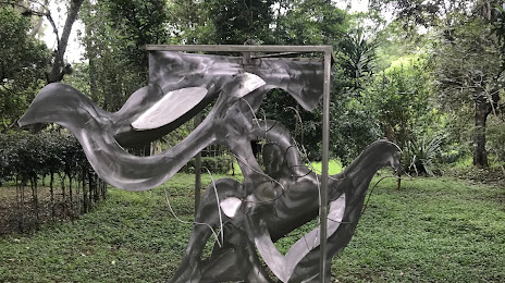
Photo
Where is located El Tejar-Garnica
El Tejar-Garnica — local attraction, which is located at Av. Rafael Murillo Vidal, Cuauhtémoc, 91069 Xalapa-Enríquez, Ver., Mexico and belongs to the category — nature preserve. Average visitor rating for this place — 4.4 (according to 77 ratings, information from open sources and relevant for 2022).
Exact location — El Tejar-Garnica, marked on the map with a red marker.
You can get directions to El Tejar-Garnica on the map from your location.
What else is interesting in Xalapa? You can see all the sights if you go to the city page.
Coordinates
El Tejar-Garnica, Mexico coordinates in decimal format: latitude — 19.519172100289342, longitude — -96.89823929290812. When converted to degrees, minutes, seconds El Tejar-Garnica has the following coordinates: 19°31′9.02 north latitude and -96°53′53.66 east longitude.
Nearby cities
The largest cities that are located nearby:
- Martínez de la Torre — 59 km
- Córdoba — 73 km
- Orizaba — 79 km
- Poza Rica de Hidalgo — 123 km
- Tehuacán — 130 km
- Puebla — 146 km
- Tulancingo — 163 km
- Pachuca — 202 km
- Texcoco — 206 km
- Ixtapaluca — 207 km
- Chalco de Díaz Covarrubias — 210 km
- Chimalhuacan — 214 km
- Ciudad Nezahualcóyotl — 217 km
- Ojo de Agua — 221 km
- Ecatepec — 223 km
- Coacalco — 229 km
- Cuautla — 229 km
- Buenavista — 236 km
- Tlalnepantla — 238 km
Distance to the capital
Distance to the capital (Mexico City) is about — 235 km.