 Bel-Ha
San Jose El Alto
El Porvenir
Nueva Palestina
Santa Lucía
Chemax
La Morita
Temoac
Zacualpan
Bel-Ha
San Jose El Alto
El Porvenir
Nueva Palestina
Santa Lucía
Chemax
La Morita
Temoac
Zacualpan
Península El Mogote on the map, La Paz, Mexico
Photo
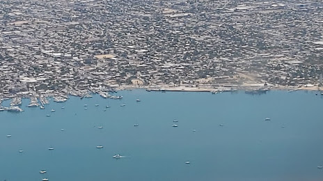
Where is located Península El Mogote
Península El Mogote — local attraction, which is located at no data and belongs to the category — -. Average visitor rating for this place — 5.0 (according to 5 ratings, information from open sources and relevant for 2022).
Exact location — Península El Mogote, marked on the map with a red marker.
You can get directions to Península El Mogote on the map from your location.
What else is interesting in La Paz? You can see all the sights if you go to the city page.
Coordinates
Península El Mogote, Mexico coordinates in decimal format: latitude — 24.114227420320336, longitude — -110.32180946335893. When converted to degrees, minutes, seconds Península El Mogote has the following coordinates: 24°6′51.22 north latitude and -110°19′18.51 east longitude.
Nearby cities
The largest cities that are located nearby:
- Los Mochis — 225 km
- Navojoa — 335 km
- Ciudad Obregón — 371 km
- Mazatlán — 408 km
- Guaymas — 421 km
- Hermosillo — 549 km
- Durango — 572 km
- Tepic — 629 km
- Chihuahua — 645 km
- Delicias — 650 km
- Puerto Vallarta — 653 km
- Gómez Palacio — 699 km
- Torreón — 706 km
- Matamoros — 723 km
- Fresnillo — 764 km
- Nogales
 (United States) — 798 km
 - Zacatecas — 802 km
- Zapopan — 810 km
- Guadalajara — 817 km
Distance to the capital
Distance to the capital (Mexico City) is about — 1267 km.