
 Belém
Maranguape
Paranaguá
Paranaguá
Monte Alegre
Alvorada de Minas
Bragança
Laguna
Ibiporã
Belém
Maranguape
Paranaguá
Paranaguá
Monte Alegre
Alvorada de Minas
Bragança
Laguna
Ibiporã
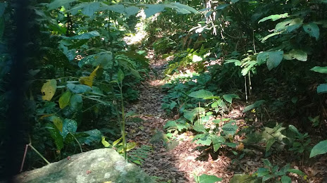
STATE PARK SERRA Tiririca - Peset (PARQUE ESTADUAL DA SERRA DA TIRIRICA - PESET) on the map, Niterói, Brazil
Photo
Where is located STATE PARK SERRA Tiririca - Peset (PARQUE ESTADUAL DA SERRA DA TIRIRICA - PESET)
STATE PARK SERRA Tiririca - Peset (PARQUE ESTADUAL DA SERRA DA TIRIRICA - PESET) — local attraction, which is located at DIVISA NITERÓI/, Maricá - RJ, Brazil and belongs to the category — state park. Average visitor rating for this place — 4.5 (according to 17 ratings, information from open sources and relevant for 2022).
Exact location — STATE PARK SERRA Tiririca - Peset (PARQUE ESTADUAL DA SERRA DA TIRIRICA - PESET), marked on the map with a red marker.
You can get directions to STATE PARK SERRA Tiririca - Peset (PARQUE ESTADUAL DA SERRA DA TIRIRICA - PESET) on the map from your location.
What else is interesting in Niterói? You can see all the sights if you go to the city page.
Coordinates
STATE PARK SERRA Tiririca - Peset (PARQUE ESTADUAL DA SERRA DA TIRIRICA - PESET), Brazil coordinates in decimal format: latitude — -22.948551042948868, longitude — -43.00585859279957. When converted to degrees, minutes, seconds STATE PARK SERRA Tiririca - Peset (PARQUE ESTADUAL DA SERRA DA TIRIRICA - PESET) has the following coordinates: -22°56′54.78 north latitude and -43°0′21.09 east longitude.
Nearby cities
The largest cities that are located nearby:
- Rio de Janeiro — 6 km
- São Gonçalo — 8 km
- Duque de Caxias — 22 km
- Magé — 26 km
- São João de Meriti — 28 km
- Itaboraí — 29 km
- Belford Roxo — 32 km
- Nilópolis — 32 km
- Nova Iguaçu — 38 km
- Petrópolis — 42 km
- Queimados — 49 km
- Teresópolis — 54 km
- Araruama — 80 km
- Volta Redonda — 108 km
- Cabo Frio — 111 km
- Barra Mansa — 115 km
- Angra dos Reis — 123 km
- Juiz de Fora — 126 km
- Resende — 144 km