
Other locations
Uruará  Belém
Maranguape
Paranaguá
Paranaguá
Monte Alegre
Alvorada de Minas
Bragança
Laguna
Ibiporã
Belém
Maranguape
Paranaguá
Paranaguá
Monte Alegre
Alvorada de Minas
Bragança
Laguna
Ibiporã
Ponta Verde on the map, Maceió, Brazil
Comments
Where is located Ponta Verde on the map, Maceió, Brazil. Geographic coordinates in decimal format, as well as degrees, minutes and seconds. Photo, address and average rating of visitors who have been here.
Photo
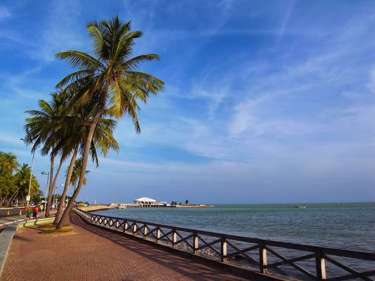
Where is located Ponta Verde
Ponta Verde — local attraction, which is located at no data and belongs to the category — -. Average visitor rating for this place — 4.7 (according to 1900 ratings, information from open sources and relevant for 2022).
Exact location — Ponta Verde, marked on the map with a red marker.
You can get directions to Ponta Verde on the map from your location.
What else is interesting in Maceió? You can see all the sights if you go to the city page.
Coordinates
Ponta Verde, Brazil coordinates in decimal format: latitude — -9.660811186650493, longitude — -35.7035850537497. When converted to degrees, minutes, seconds Ponta Verde has the following coordinates: -9°39′38.92 north latitude and -35°42′12.91 east longitude.
Nearby cities
The largest cities that are located nearby:
- Arapiraca — 105 km
- Caruaru — 154 km
- Jaboatão dos Guararapes — 181 km
- Camaragibe — 197 km
- Recife — 198 km
- Aracaju — 206 km
- Campina Grande — 269 km
- Santa Rita — 290 km
- João Pessoa — 295 km
- Alagoinhas — 402 km
- Parnamirim — 416 km
- Natal — 432 km
- Camaçari — 440 km
- Lauro de Freitas — 455 km
- Feira de Santana — 455 km
- Salvador — 475 km
- Juazeiro do Norte — 477 km
- Petrolina — 524 km
- Mossoro — 526 km