
 Belém
Maranguape
Paranaguá
Paranaguá
Monte Alegre
Alvorada de Minas
Bragança
Laguna
Ibiporã
Belém
Maranguape
Paranaguá
Paranaguá
Monte Alegre
Alvorada de Minas
Bragança
Laguna
Ibiporã
Parcão Municipal Cachoeirinha on the map, Cachoeirinha, Brazil
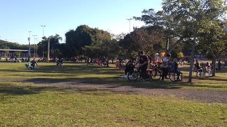
Photo
Where is located Parcão Municipal Cachoeirinha
Parcão Municipal Cachoeirinha — local attraction, which is located at R. Monteiro Lobato, S/N - Parque da Matriz, Cachoeirinha - RS, 94950-280, Brazil and belongs to the category — park. Average visitor rating for this place — 4.3 (according to 3722 ratings, information from open sources and relevant for 2022).
Exact location — Parcão Municipal Cachoeirinha, marked on the map with a red marker.
You can get directions to Parcão Municipal Cachoeirinha on the map from your location.
What else is interesting in Cachoeirinha? You can see all the sights if you go to the city page.
Coordinates
Parcão Municipal Cachoeirinha, Brazil coordinates in decimal format: latitude — -29.940757360844348, longitude — -51.08374289265313. When converted to degrees, minutes, seconds Parcão Municipal Cachoeirinha has the following coordinates: -29°56′26.73 north latitude and -51°5′1.47 east longitude.
Nearby cities
The largest cities that are located nearby:
- Canoas — 9 km
- Gravataí — 11 km
- Porto Alegre — 15 km
- Viamão — 17 km
- São Leopoldo — 22 km
- Guaíba — 28 km
- Novo Hamburgo — 29 km
- Caxias do Sul — 87 km
- Santa Cruz do Sul — 130 km
- Criciúma — 219 km
- Passo Fundo — 226 km
- Pelotas — 232 km
- Lages — 248 km
- Rio Grande — 249 km
- Santa Maria — 262 km
- Chapecó — 348 km
- Palhoça — 349 km
- São José — 353 km
- Florianópolis — 361 km