 Derrumbadero
La Rancha
San Juan de la Maguana
Espaillat Province
Tábara Arriba
Cibao International Airport
Mao
Punta Cana International Airport
Moca
Derrumbadero
La Rancha
San Juan de la Maguana
Espaillat Province
Tábara Arriba
Cibao International Airport
Mao
Punta Cana International Airport
Moca
Bayahibe Beach on the map, La Romana, Dominican Republic
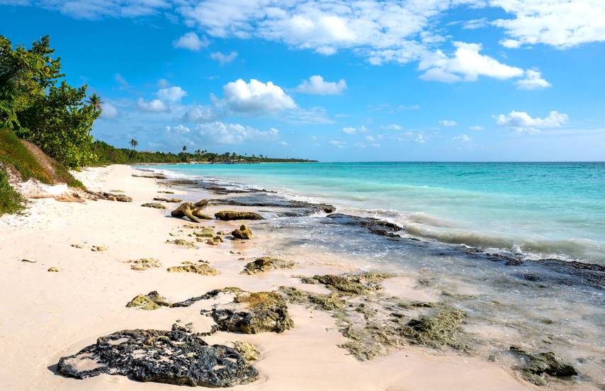
Photo
Where is located Bayahibe Beach
Bayahibe Beach — local attraction, which is located at no data and belongs to the category — -. Average visitor rating for this place — 4.6 (according to 523 ratings, information from open sources and relevant for 2022).
Exact location — Bayahibe Beach, marked on the map with a red marker.
You can get directions to Bayahibe Beach on the map from your location.
What else is interesting in La Romana? You can see all the sights if you go to the city page.
Coordinates
Bayahibe Beach, Dominican Republic coordinates in decimal format: latitude — 18.317260728802985, longitude — -68.78054959019153. When converted to degrees, minutes, seconds Bayahibe Beach has the following coordinates: 18°19′2.14 north latitude and -68°46′49.98 east longitude.
Nearby cities
The largest cities that are located nearby:
- San Pedro de Macoris — 35 km
- Punta Cana — 62 km
- San Cristobal — 119 km
- San Francisco de Macoris — 165 km
- La Vega — 185 km
- Santiago De Los Caballeros — 214 km
- Puerto Plata — 233 km
- Ponce
 (Puerto Rico) — 252 km
 - Bayamón
 (Puerto Rico) — 292 km
 - Saint John (Puerto Rico) — 300 km
- Carolina (Puerto Rico) — 316 km
- Port-au-Prince
 (Haiti) — 353 km
 - Carrefour (Haiti) — 361 km
- Cap-Haitien (Haiti) — 367 km
- Léogâne (Haiti) — 383 km
- Guantanamo
 (Cuba) — 675 km
 - Santiago de Cuba (Cuba) — 734 km
- Setpoint
 (Venezuela) — 754 km
 - Palma Soriano (Cuba) — 754 km
Distance to the capital
Distance to the capital (Santo Domingo) is about — 125 km.