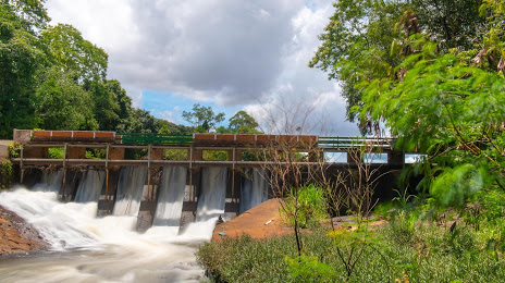
Igarapava — Cáceres
Igarapava — Cubatão
Igarapava — Altônia
Igarapava — Barra do Quaraí
Igarapava — Carutapera
Igarapava — Iaçu
Igarapava — Petrópolis
Igarapava — Caldas
Igarapava — Visconde do Rio Branco
Igarapava — Uberaba
Igarapava — Paula Cândido
Igarapava — Tamboara
Igarapava — Saudades
Igarapava — Riacho das Almas
Igarapava — Centralina
Igarapava — Arraial d'Ajuda
Igarapava — Tiradentes
Igarapava — Lins
Igarapava — Marinópolis
Ituverava
Guará
São Joaquim da Barra
São Joaquim da Barra
Orlândia
Sales Oliveira
Jardinópolis
Ribeirão Preto
Ribeirão Preto
Américo Brasiliense
Boa Esperança do Sul
Pederneiras
Bauru
Piratininga
Espírito Santo do Turvo
Santa Cruz do Rio Pardo
Ourinhos
Cambará
Andirá
Bandeirantes
Cornélio Procópio
Uraí
Uraí
Jataìzinho
Ibiporã
Igarapava — Ibiporã distance, route on the map
Distance by car
Distance between Igarapava, São Paulo, Brazil and Ibiporã, Paraná, Brazil by car is — km, or miles. To travel this distance by car, you need minute, or h.
Route on the map, driving directions
Car route Igarapava — Ibiporã was created automatically. The road on the map is shown as a blue line. By moving the markers, you can create a new route through the points you need.
Passing cities through which the car route passes: Aramina, Ituverava, Guará, São Joaquim da Barra, São Joaquim da Barra, Orlândia, Sales Oliveira, Jardinópolis, Ribeirão Preto, Ribeirão Preto, Américo Brasiliense, Boa Esperança do Sul, Pederneiras, Bauru, Piratininga, Espírito Santo do Turvo, Santa Cruz do Rio Pardo, Ourinhos, Cambará, Andirá, Bandeirantes, Cornélio Procópio, Uraí, Uraí, Jataìzinho, Ibiporã.
Distance by plane
If you decide to take a trip Igarapava Ibiporã by plane, then you have to fly the distance — 495 km or 307 miles. It is marked on the map with a gray line (between two points in a straight line).
Flight time
Estimated flight time Igarapava Ibiporã by plane at cruising speed 750 km / h will be — 39 min.
Direction of movement
Brazil, Igarapava — right-hand traffic. Brazil, Ibiporã — right-hand traffic.
Difference in time
Igarapava and Ibiporã are in the same time zone. Between them there is no time difference (UTC -3 America/Sao_Paulo).
Interesting Facts
Information on alternative ways to get to your destination.
The length of this distance is about 1.2% of the total length of the equator.
The percentage of the population is clearly shown in the graph:
Igarapava — 29,058 (less by 15,733), Ibiporã — 44,791 residents.
The cost of travel
Calculate the cost of the trip yourself using the fuel consumption calculator, changing the data in the table.