Goianápolis — Aguaí
Goianápolis — São Vicente do Sul
Goianápolis — Aeroporto De Para De Minas
Goianápolis — Assaí
Goianápolis — Amaral Ferrador
Goianápolis — Natuba
Goianápolis — Saquarema
Goianápolis — Guará
Goianápolis — Vargem Grande
Goianápolis — Pareci Novo
Goianápolis — Jaguapitã
Goianápolis — Goianésia
Goianápolis — Aroeiras
Goianápolis — Santa Isabel
Goianápolis — Rifaina
Goianápolis — Água Boa
Goianápolis — Penha
Goianápolis — Guarda-Mor
Goianápolis — Diamantino
Anápolis
Abadiânia
Alexânia
Taguatinga
35
Brasilia
Planaltina
Formosa
Vila Boa
Posse
Barreiras
Formosa do Rio Preto
Floriano
Oeiras
Peaks
Vila Nova do Piauí
Fronteiras
Campos Sales
Iguatu
Icó
Jaguaribe
Jaguaribe
Jaguaribara
Tabuleiro do Norte
Limoeiro do Norte
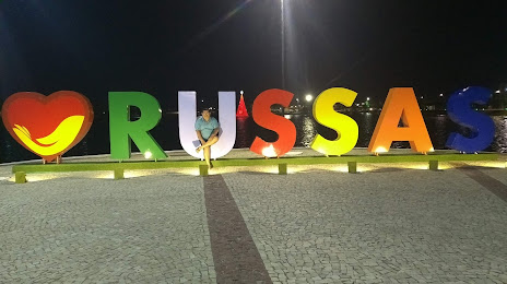
Goianápolis — Russas distance, route on the map
Distance by car
Distance between Goianápolis, Goiás, Brazil and Russas, Ceará, Brazil by car is — km, or miles. To travel this distance by car, you need minute, or h.
Route on the map, driving directions
Car route Goianápolis — Russas was created automatically. The road on the map is shown as a blue line. By moving the markers, you can create a new route through the points you need.
Passing cities through which the car route passes: Anápolis, Anápolis, Abadiânia, Alexânia, Taguatinga, 35, Brasilia, Planaltina, Formosa, Vila Boa, Posse, Barreiras, Formosa do Rio Preto, Floriano, Oeiras, Peaks, Vila Nova do Piauí, Fronteiras, Campos Sales, Iguatu, Icó, Jaguaribe, Jaguaribe, Jaguaribara, Tabuleiro do Norte, Limoeiro do Norte.
Distance by plane
If you decide to take a trip Goianápolis Russas by plane, then you have to fly the distance — 1764 km or 1094 miles. It is marked on the map with a gray line (between two points in a straight line).
Flight time
Estimated flight time Goianápolis Russas by plane at cruising speed 750 km / h will be — 2 h. and 21 min.
Direction of movement
Brazil, Goianápolis — right-hand traffic. Brazil, Russas — right-hand traffic.
Difference in time
Goianápolis and Russas are in the same time zone. Between them there is no time difference (UTC -3 America/Sao_Paulo).
Interesting Facts
Information on alternative ways to get to your destination.
The length of this distance is about 4.4% of the total length of the equator.
The percentage of the population is clearly shown in the graph:
Goianápolis — 10,114 (less by 29,351), Russas — 39,465 residents.
The cost of travel
Calculate the cost of the trip yourself using the fuel consumption calculator, changing the data in the table.