
 San José del Palmar
Nocaima
Quipile
Tuta
Juan De Acosta
Venadillo
Pasca
Yolombo
El Cairo
Sonson
La Ceja
San Jeronimo
Madrid
Rovira
Circasia
La Victoria
Cumaral
Socorro
Suesca
San José del Palmar
Nocaima
Quipile
Tuta
Juan De Acosta
Venadillo
Pasca
Yolombo
El Cairo
Sonson
La Ceja
San Jeronimo
Madrid
Rovira
Circasia
La Victoria
Cumaral
Socorro
Suesca
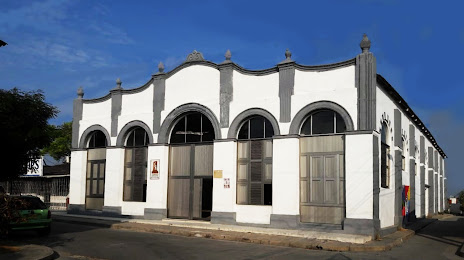
Turbaco on the map, Colombia
Where is located Turbaco
Exact location — Turbaco, Turbaco, Bolívar, Colombia, marked on the map with a red marker.
Coordinates
Turbaco, Colombia coordinates in decimal format: latitude — 10.32775, longitude — -75.40883. When converted to degrees, minutes, seconds Turbaco has the following coordinates: 10°19′39.9 north latitude and -75°24′31.79 east longitude.
Population
Turbaco, Turbaco, Bolívar, Colombia, according to our data the population is — 56,173 residents, which is about 0.1% of the total population of the country (Colombia).
Comparison of the population on the graph:
Exact time
Time zone for this location Turbaco — UTC -5 America/Bogota. Exact time — saturday, 4 april 2024 year, 07 h. 26 minutes.
Sunrise and sunset
Turbaco, sunrise and sunset data for a date — saturday 27.04.2024.
| Sunrise | Sunset | Day (duration) |
|---|---|---|
| 05:47 -0 minutes | 18:10 -0 minutes | 12 h. 24 minutes. -0 minutes |
You can control the scale of the map using the auxiliary tools to find out exactly where it is located Turbaco. When you change the scale of the map, the width of the ruler also changes (in kilometers and miles).
Nearby cities
The largest cities that are located nearby:
- Cartagena — 17 km
- Malambo — 91 km
- Soledad — 95 km
- Barranquilla — 98 km
- Sincelejo — 113 km
- Magangué — 140 km
- Santa Marta — 165 km
- Monteria — 182 km
- Valledupar — 235 km
- Maicao — 363 km
- Barrancabermeja — 400 km
- Maracaibo
 (Venezuela) — 412 km
 - Cúcuta — 417 km
- Cabimas (Venezuela) — 428 km
- Bucaramanga — 433 km
- Giron — 436 km
- Bello — 442 km
- Floridablanca — 442 km
- San Cristobal (Venezuela) — 449 km
Distance to neighboring capitals:
- Panama
 (Panama) — 475 km
 - Caracas (Venezuela) — 927 km
- San Jose
 (Costa Rica) — 952 km
 - Quito
 (Ecuador) — 1217 km
 - Georgetown
 (Guyana) — 1936 km
 - Nuestra Señora de La Paz
 (Bolivia) — 3089 km
 - Asuncion
 (Paraguay) — 4405 km
 - Santiago
 (Chile) — 4894 km
 - Buenos Aires
 (Argentina) — 5310 km
 - Montevideo
 (Uruguay) — 5424 km
Attractions
Distance to the capital
Distance to the capital (Bogota) is about — 654 km.