
 Belém
Maranguape
Paranaguá
Paranaguá
Monte Alegre
Alvorada de Minas
Bragança
Laguna
Ibiporã
Belém
Maranguape
Paranaguá
Paranaguá
Monte Alegre
Alvorada de Minas
Bragança
Laguna
Ibiporã
Praia do Vargas, Araruama on the map, Araruama, Brazil
Photo
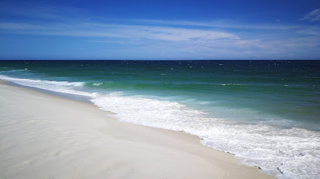
Where is located Praia do Vargas, Araruama
Praia do Vargas, Araruama — local attraction, which is located at no data and belongs to the category — -. Average visitor rating for this place — 4.6 (according to 505 ratings, information from open sources and relevant for 2022).
Exact location — Praia do Vargas, Araruama, marked on the map with a red marker.
You can get directions to Praia do Vargas, Araruama on the map from your location.
What else is interesting in Araruama? You can see all the sights if you go to the city page.
Coordinates
Praia do Vargas, Araruama, Brazil coordinates in decimal format: latitude — -22.936280817072483, longitude — -42.3312118509446. When converted to degrees, minutes, seconds Praia do Vargas, Araruama has the following coordinates: -22°56′10.61 north latitude and -42°19′52.36 east longitude.
Nearby cities
The largest cities that are located nearby:
- Cabo Frio — 31 km
- Itaboraí — 55 km
- São Gonçalo — 75 km
- Magé — 76 km
- Macaé — 77 km
- Niterói — 80 km
- Teresópolis — 82 km
- Rio de Janeiro — 86 km
- Petrópolis — 95 km
- Duque de Caxias — 99 km
- São João de Meriti — 106 km
- Belford Roxo — 109 km
- Nilópolis — 111 km
- Nova Iguaçu — 116 km
- Queimados — 125 km
- Juiz de Fora — 160 km
- Volta Redonda — 184 km
- Barra Mansa — 192 km
- Angra dos Reis — 202 km