
 Belém
Maranguape
Paranaguá
Paranaguá
Monte Alegre
Alvorada de Minas
Bragança
Laguna
Ibiporã
Belém
Maranguape
Paranaguá
Paranaguá
Monte Alegre
Alvorada de Minas
Bragança
Laguna
Ibiporã
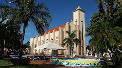
Paróquia São João Batista on the map, Santa Fé do Sul, Brazil
Photo
Where is located Paróquia São João Batista
Paróquia São João Batista — local attraction, which is located at Praça da Matriz - Centro, Santa Fé do Sul - SP, 15775-000, Brazil and belongs to the category — church. Average visitor rating for this place — 4.9 (according to 10 ratings, information from open sources and relevant for 2022).
Exact location — Paróquia São João Batista, marked on the map with a red marker.
You can get directions to Paróquia São João Batista on the map from your location.
What else is interesting in Santa Fé do Sul? You can see all the sights if you go to the city page.
Coordinates
Paróquia São João Batista, Brazil coordinates in decimal format: latitude — -20.210407914314583, longitude — -50.92656289284661. When converted to degrees, minutes, seconds Paróquia São João Batista has the following coordinates: -20°12′37.47 north latitude and -50°55′35.63 east longitude.
Nearby cities
The largest cities that are located nearby:
- Birigui — 134 km
- Presidente Prudente — 216 km
- Catanduva — 225 km
- Marília — 243 km
- Barretos — 247 km
- Assis — 276 km
- Bauru — 301 km
- Uberlândia — 312 km
- Uberaba — 315 km
- Araraquara — 331 km
- Ribeirão Preto — 338 km
- Franca — 367 km
- Maringá — 369 km
- São Carlos — 369 km
- Apucarana — 373 km
- Campo Grande — 384 km
- Botucatu — 389 km
- Rio Claro — 421 km
- Goiânia — 428 km