
 Belém
Maranguape
Paranaguá
Paranaguá
Monte Alegre
Alvorada de Minas
Bragança
Laguna
Ibiporã
Belém
Maranguape
Paranaguá
Paranaguá
Monte Alegre
Alvorada de Minas
Bragança
Laguna
Ibiporã
Praia de Atalaia - Aracaju on the map, Aracaju, Brazil
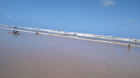
Photo
Where is located Praia de Atalaia - Aracaju
Praia de Atalaia - Aracaju — local attraction, which is located at Coroa do Meio, Aracaju - State of Sergipe, Brazil and belongs to the category — tourist attraction. Average visitor rating for this place — 4.6 (according to 111 ratings, information from open sources and relevant for 2022).
Exact location — Praia de Atalaia - Aracaju, marked on the map with a red marker.
You can get directions to Praia de Atalaia - Aracaju on the map from your location.
What else is interesting in Aracaju? You can see all the sights if you go to the city page.
Coordinates
Praia de Atalaia - Aracaju, Brazil coordinates in decimal format: latitude — -10.995874592766908, longitude — -37.103580743495314. When converted to degrees, minutes, seconds Praia de Atalaia - Aracaju has the following coordinates: -10°59′45.15 north latitude and -37°6′12.89 east longitude.
Nearby cities
The largest cities that are located nearby:
- Arapiraca — 139 km
- Alagoinhas — 196 km
- Maceió — 207 km
- Camaçari — 236 km
- Feira de Santana — 251 km
- Lauro de Freitas — 252 km
- Salvador — 272 km
- Caruaru — 318 km
- Jaboatão dos Guararapes — 382 km
- Camaragibe — 396 km
- Recife — 399 km
- Petrolina — 412 km
- Campina Grande — 432 km
- Jequié — 456 km
- Ilhéus — 475 km
- Juazeiro do Norte — 479 km
- Santa Rita — 481 km
- Itabuna — 486 km
- João Pessoa — 489 km