
 Belém
Maranguape
Paranaguá
Paranaguá
Monte Alegre
Alvorada de Minas
Bragança
Laguna
Ibiporã
Belém
Maranguape
Paranaguá
Paranaguá
Monte Alegre
Alvorada de Minas
Bragança
Laguna
Ibiporã
Municipal Park Dona Ziza on the map, Formiga, Brazil
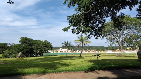
Photo
Where is located Municipal Park Dona Ziza
Municipal Park Dona Ziza — local attraction, which is located at Pains, State of Minas Gerais, 35582-000, Brazil and belongs to the category — park. Average visitor rating for this place — 4.8 (according to 193 ratings, information from open sources and relevant for 2022).
Exact location — Municipal Park Dona Ziza, marked on the map with a red marker.
You can get directions to Municipal Park Dona Ziza on the map from your location.
What else is interesting in Formiga? You can see all the sights if you go to the city page.
Coordinates
Municipal Park Dona Ziza, Brazil coordinates in decimal format: latitude — -20.3756927345752, longitude — -45.65604690255319. When converted to degrees, minutes, seconds Municipal Park Dona Ziza has the following coordinates: -20°22′32.49 north latitude and -45°39′21.77 east longitude.
Nearby cities
The largest cities that are located nearby:
- Divinópolis — 66 km
- Betim — 139 km
- Esmeraldas — 149 km
- Ibirité — 150 km
- Contagem — 152 km
- Ribeirão das Neves — 160 km
- Sete Lagoas — 166 km
- Belo Horizonte — 166 km
- Santa Luzia — 172 km
- Sabará — 178 km
- Poços de Caldas — 187 km
- Barbacena — 190 km
- Franca — 205 km
- Patos de Minas — 237 km
- Resende — 243 km
- Juiz de Fora — 258 km
- Ribeirão Preto — 258 km
- Guaratinguetá — 260 km
- Barra Mansa — 263 km