
 Lauterbach
Marburg
Sulzbach-Rosenberg
Coburg
Zwickau
Schwaig
Ostfildern
Ramstein-Miesenbach
Buchen
Bonndorf
Steinhagen
Flensburg
Norderstedt
Eningen
Arnsberg
Mörfelden
Lüdenscheid
Neuenhagen
Adelheidsdorf
Lauterbach
Marburg
Sulzbach-Rosenberg
Coburg
Zwickau
Schwaig
Ostfildern
Ramstein-Miesenbach
Buchen
Bonndorf
Steinhagen
Flensburg
Norderstedt
Eningen
Arnsberg
Mörfelden
Lüdenscheid
Neuenhagen
Adelheidsdorf
Holzminden on the map, Germany
Where is located Holzminden
Exact location — Holzminden, Lower Saxony, Germany, marked on the map with a red marker.
Coordinates
Holzminden, Germany coordinates in decimal format: latitude — 51.8238111, longitude — 9.4558926. When converted to degrees, minutes, seconds Holzminden has the following coordinates: 51°49′25.72 north latitude and 9°27′21.21 east longitude.
Population
Holzminden, Lower Saxony, Germany, according to our data the population is — 21,028 residents, which is about 0% of the total population of the country (Germany).
Comparison of the population on the graph:
Exact time
Time zone for this location Holzminden — UTC +2 Europe/Berlin. Exact time — saturday, 5 may 2024 year, 15 h. 11 minutes.
Sunrise and sunset
Holzminden, sunrise and sunset data for a date — saturday 4.05.2024.
| Sunrise | Sunset | Day (duration) |
|---|---|---|
| 05:50 -2 minutes | 20:47 +2 minutes | 15 h. 0 minutes. +4 minutes |
You can control the scale of the map using the auxiliary tools to find out exactly where it is located Holzminden. When you change the scale of the map, the width of the ruler also changes (in kilometers and miles).
Nearby cities
The largest cities that are located nearby:
- Göttingen — 44 km
- Paderborn — 49 km
- Hildesheim — 50 km
- Kassel — 57 km
- Hanover — 64 km
- Bielefeld — 67 km
- Salzgitter — 70 km
- Brunswick — 88 km
- Osnabrück — 108 km
- Wolfsburg — 112 km
- Hamm — 114 km
- Münster — 126 km
- Dortmund — 141 km
- Erfurt — 144 km
- Siegen — 144 km
- Bremen — 145 km
- Hagen — 147 km
- Witten — 151 km
- Magdeburg — 151 km
Distance to neighboring capitals:
- Amsterdam
 (Netherlands) — 317 km
 - Brussels
 (Belgium) — 371 km
 - Prague
 (Czech Republic) — 399 km
 - Copenhagen
 (Denmark) — 475 km
 - Vaduz
 (Liechtenstein) — 521 km
 - Bern
 (Switzerland) — 561 km
 - Paris
 (France) — 602 km
 - Paris (France) — 602 km
- Vienna
 (Austria) — 637 km
 - Ljubljana
 (Slovenia) — 740 km
 - Warsaw
 (Poland) — 791 km
 - Oslo
 (Norway) — 903 km
 - Stockholm
 (Sweden) — 987 km
 - Rome
 (Italy) — 1127 km
 - Minsk
 (Belarus) — 1234 km
 - Helsinki
 (Finland) — 1332 km
 - Kyiv
 (Ukraine) — 1473 km
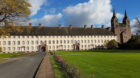
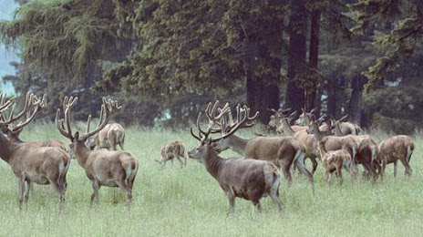
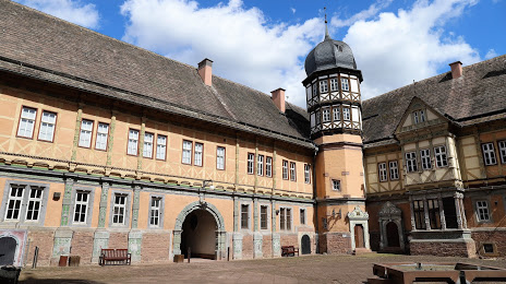
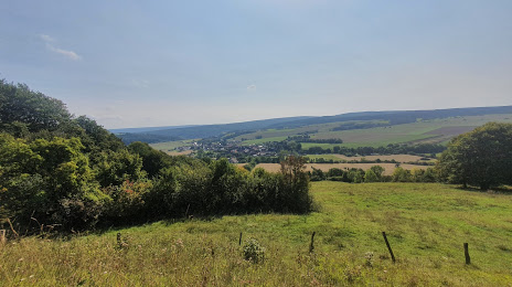
Attractions


Distance to the capital
Distance to the capital (Berlin) is about — 280 km.