
 Belém
Maranguape
Paranaguá
Paranaguá
Monte Alegre
Alvorada de Minas
Bragança
Laguna
Ibiporã
Belém
Maranguape
Paranaguá
Paranaguá
Monte Alegre
Alvorada de Minas
Bragança
Laguna
Ibiporã
National Forest Canela on the map, Gramado, Brazil
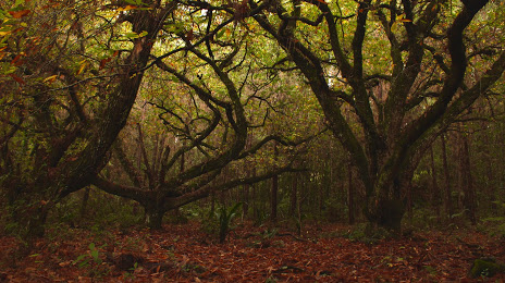
Photo
Where is located National Forest Canela
National Forest Canela — local attraction, which is located at Rua Otaviano do Amaral Pires, 5000 Cxp. Postal 82 Bairro Ulisses de Abreu Cep 95.680-000, Canela - RS, 95680-000, Brazil and belongs to the category — national forest. Average visitor rating for this place — 4.5 (according to 192 ratings, information from open sources and relevant for 2022).
Exact location — National Forest Canela, marked on the map with a red marker.
You can get directions to National Forest Canela on the map from your location.
What else is interesting in Gramado? You can see all the sights if you go to the city page.
Coordinates
National Forest Canela, Brazil coordinates in decimal format: latitude — -29.358653164039207, longitude — -50.84562930667564. When converted to degrees, minutes, seconds National Forest Canela has the following coordinates: -29°21′31.15 north latitude and -50°50′44.27 east longitude.
Nearby cities
The largest cities that are located nearby:
- Caxias do Sul — 37 km
- Novo Hamburgo — 43 km
- São Leopoldo — 50 km
- Gravataí — 64 km
- Canoas — 67 km
- Cachoeirinha — 67 km
- Viamão — 79 km
- Porto Alegre — 80 km
- Guaíba — 92 km
- Santa Cruz do Sul — 155 km
- Criciúma — 165 km
- Lages — 181 km
- Passo Fundo — 194 km
- Santa Maria — 284 km
- Palhoça — 288 km
- São José — 293 km
- Pelotas — 298 km
- Florianópolis — 301 km
- Chapecó — 304 km