
 Belém
Maranguape
Paranaguá
Paranaguá
Monte Alegre
Alvorada de Minas
Bragança
Laguna
Ibiporã
Belém
Maranguape
Paranaguá
Paranaguá
Monte Alegre
Alvorada de Minas
Bragança
Laguna
Ibiporã
Praça do Avião on the map, Rio Negrinho, Brazil
Photo
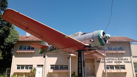
Where is located Praça do Avião
Praça do Avião — local attraction, which is located at Centro, Rio Negrinho - State of Santa Catarina, 89295-000, Brazil and belongs to the category — memorial park. Average visitor rating for this place — 4.7 (according to 209 ratings, information from open sources and relevant for 2022).
Exact location — Praça do Avião, marked on the map with a red marker.
You can get directions to Praça do Avião on the map from your location.
What else is interesting in Rio Negrinho? You can see all the sights if you go to the city page.
Coordinates
Praça do Avião, Brazil coordinates in decimal format: latitude — -26.2545346660519, longitude — -49.518267202443965. When converted to degrees, minutes, seconds Praça do Avião has the following coordinates: -26°15′16.32 north latitude and -49°31′5.76 east longitude.
Nearby cities
The largest cities that are located nearby:
- Jaraguá do Sul — 51 km
- Joinville — 67 km
- Araucária — 74 km
- São José dos Pinhais — 85 km
- Blumenau — 86 km
- Curitiba — 94 km
- Pinhais — 95 km
- Colombo — 110 km
- Itajaí — 111 km
- Paranaguá — 128 km
- São José — 174 km
- Palhoça — 175 km
- Florianópolis — 177 km
- Lages — 190 km
- Guarapuava — 216 km
- Criciúma — 268 km
- Chapecó — 319 km
- Itapetininga — 330 km
- Apucarana — 358 km