
 Belém
Maranguape
Paranaguá
Paranaguá
Monte Alegre
Alvorada de Minas
Bragança
Laguna
Ibiporã
Belém
Maranguape
Paranaguá
Paranaguá
Monte Alegre
Alvorada de Minas
Bragança
Laguna
Ibiporã
Praia de Putiri on the map, Aracruz, Brazil
Photo
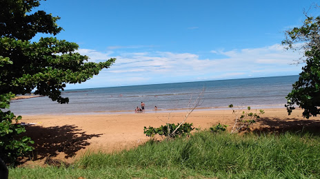
Where is located Praia de Putiri
Praia de Putiri — local attraction, which is located at Putiri, Aracruz - State of Espírito Santo, 29198-468, Brazil and belongs to the category — tourist attraction. Average visitor rating for this place — 4.7 (according to 164 ratings, information from open sources and relevant for 2022).
Exact location — Praia de Putiri, marked on the map with a red marker.
You can get directions to Praia de Putiri on the map from your location.
What else is interesting in Aracruz? You can see all the sights if you go to the city page.
Coordinates
Praia de Putiri, Brazil coordinates in decimal format: latitude — -19.901104604853053, longitude — -40.0964547906175. When converted to degrees, minutes, seconds Praia de Putiri has the following coordinates: -19°54′3.98 north latitude and -40°5′47.24 east longitude.
Nearby cities
The largest cities that are located nearby:
- Serra — 33 km
- Cariacica — 51 km
- Linhares — 52 km
- Colatina — 54 km
- Vila Velha — 58 km
- Guarapari — 97 km
- Cachoeiro de Itapemirim — 143 km
- Valadares Governor — 206 km
- Coronel Fabriciano — 247 km
- Teófilo Otoni — 253 km
- Macaé — 323 km
- Sabará — 369 km
- Belo Horizonte — 380 km
- Juiz de Fora — 381 km
- Santa Luzia — 381 km
- Cabo Frio — 383 km
- Barbacena — 392 km
- Ibirité — 393 km
- Porto Seguro — 395 km