
Other locations
Uruará  Belém
Maranguape
Paranaguá
Paranaguá
Monte Alegre
Alvorada de Minas
Bragança
Laguna
Ibiporã
Belém
Maranguape
Paranaguá
Paranaguá
Monte Alegre
Alvorada de Minas
Bragança
Laguna
Ibiporã
Prainha on the map, São Francisco do Sul, Brazil
Comments
Where is located Prainha on the map, São Francisco do Sul, Brazil. Geographic coordinates in decimal format, as well as degrees, minutes and seconds. Photo, address and average rating of visitors who have been here.
Photo
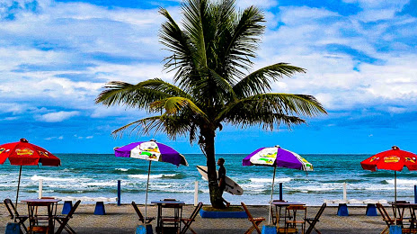
Where is located Prainha
Prainha — local attraction, which is located at no data and belongs to the category — -. Average visitor rating for this place — 4.8 (according to 582 ratings, information from open sources and relevant for 2022).
Exact location — Prainha, marked on the map with a red marker.
You can get directions to Prainha on the map from your location.
What else is interesting in São Francisco do Sul? You can see all the sights if you go to the city page.
Coordinates
Prainha, Brazil coordinates in decimal format: latitude — -26.230523869343255, longitude — -48.49964340244448. When converted to degrees, minutes, seconds Prainha has the following coordinates: -26°13′49.89 north latitude and -48°29′58.72 east longitude.
Nearby cities
The largest cities that are located nearby:
- Joinville — 22 km
- Jaraguá do Sul — 50 km
- Itajaí — 72 km
- Paranaguá — 83 km
- Blumenau — 85 km
- São José dos Pinhais — 98 km
- Pinhais — 106 km
- Araucária — 107 km
- Curitiba — 111 km
- Colombo — 122 km
- Florianópolis — 148 km
- São José — 150 km
- Palhoça — 153 km
- Lages — 239 km
- Criciúma — 276 km
- Guarapuava — 298 km
- Itapetininga — 301 km
- Sorocaba — 328 km
- Praia Grande — 335 km