
 Belém
Maranguape
Paranaguá
Paranaguá
Monte Alegre
Alvorada de Minas
Bragança
Laguna
Ibiporã
Belém
Maranguape
Paranaguá
Paranaguá
Monte Alegre
Alvorada de Minas
Bragança
Laguna
Ibiporã
Parque Natural Municipal Freymund Germer (MORRO AZUL) on the map, Pomerode, Brazil
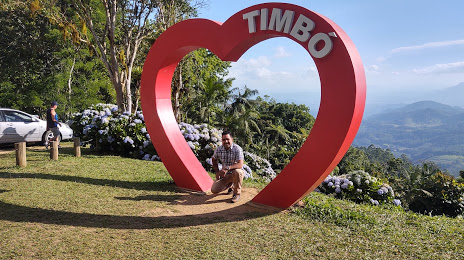
Photo
Where is located Parque Natural Municipal Freymund Germer (MORRO AZUL)
Parque Natural Municipal Freymund Germer (MORRO AZUL) — local attraction, which is located at Timbó - State of Santa Catarina, 89120-000, Brazil and belongs to the category — park. Average visitor rating for this place — 4.8 (according to 879 ratings, information from open sources and relevant for 2022).
Exact location — Parque Natural Municipal Freymund Germer (MORRO AZUL), marked on the map with a red marker.
You can get directions to Parque Natural Municipal Freymund Germer (MORRO AZUL) on the map from your location.
What else is interesting in Pomerode? You can see all the sights if you go to the city page.
Coordinates
Parque Natural Municipal Freymund Germer (MORRO AZUL), Brazil coordinates in decimal format: latitude — -26.762725256774832, longitude — -49.20990638856829. When converted to degrees, minutes, seconds Parque Natural Municipal Freymund Germer (MORRO AZUL) has the following coordinates: -26°45′45.81 north latitude and -49°12′35.66 east longitude.
Nearby cities
The largest cities that are located nearby:
- Blumenau — 22 km
- Jaraguá do Sul — 30 km
- Itajaí — 53 km
- Joinville — 58 km
- São José — 110 km
- Palhoça — 112 km
- Florianópolis — 113 km
- Araucária — 129 km
- São José dos Pinhais — 133 km
- Pinhais — 143 km
- Curitiba — 145 km
- Paranaguá — 150 km
- Colombo — 160 km
- Lages — 164 km
- Criciúma — 215 km
- Guarapuava — 273 km
- Caxias do Sul — 331 km
- Chapecó — 341 km
- Passo Fundo — 357 km