
 Belém
Maranguape
Paranaguá
Paranaguá
Monte Alegre
Alvorada de Minas
Bragança
Laguna
Ibiporã
Belém
Maranguape
Paranaguá
Paranaguá
Monte Alegre
Alvorada de Minas
Bragança
Laguna
Ibiporã
Municipal Park Mogiana on the map, Guaxupé, Brazil
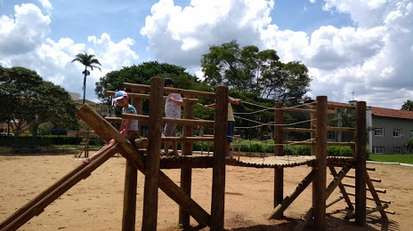
Photo
Where is located Municipal Park Mogiana
Municipal Park Mogiana — local attraction, which is located at 95,, R. Ver. Hermenegildo Paschoal, 75, Guaxupé - MG, 37800-000, Brazil and belongs to the category — city park. Average visitor rating for this place — 4.3 (according to 427 ratings, information from open sources and relevant for 2022).
Exact location — Municipal Park Mogiana, marked on the map with a red marker.
You can get directions to Municipal Park Mogiana on the map from your location.
What else is interesting in Guaxupé? You can see all the sights if you go to the city page.
Coordinates
Municipal Park Mogiana, Brazil coordinates in decimal format: latitude — -21.300318181435376, longitude — -46.71070210253786. When converted to degrees, minutes, seconds Municipal Park Mogiana has the following coordinates: -21°18′1.15 north latitude and -46°42′38.53 east longitude.
Nearby cities
The largest cities that are located nearby:
- Poços de Caldas — 55 km
- Franca — 111 km
- Ribeirão Preto — 115 km
- Araras — 135 km
- São Carlos — 144 km
- Rio Claro — 151 km
- Araraquara — 160 km
- Americana — 171 km
- Santa Bárbara D'Oeste — 176 km
- Sumaré — 177 km
- Hortolândia — 179 km
- Campinas — 181 km
- Piracicaba — 185 km
- Atibaia — 201 km
- Indaiatuba — 204 km
- Jundiaí — 209 km
- Barretos — 210 km
- Várzea Paulista — 211 km
- Uberaba — 215 km