
 Belém
Maranguape
Paranaguá
Paranaguá
Monte Alegre
Alvorada de Minas
Bragança
Laguna
Ibiporã
Belém
Maranguape
Paranaguá
Paranaguá
Monte Alegre
Alvorada de Minas
Bragança
Laguna
Ibiporã
Praia de Sirituba on the map, Barcarena, Brazil
Photo
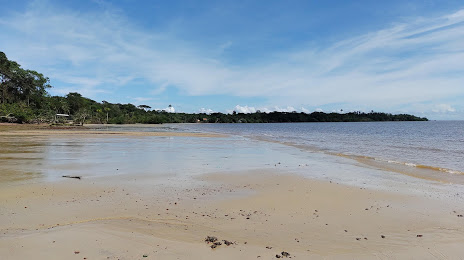
Where is located Praia de Sirituba
Praia de Sirituba — local attraction, which is located at Transtrambióca, Brazil and belongs to the category — tourist attraction. Average visitor rating for this place — 4.6 (according to 182 ratings, information from open sources and relevant for 2022).
Exact location — Praia de Sirituba, marked on the map with a red marker.
You can get directions to Praia de Sirituba on the map from your location.
What else is interesting in Barcarena? You can see all the sights if you go to the city page.
Coordinates
Praia de Sirituba, Brazil coordinates in decimal format: latitude — -1.3952726461084974, longitude — -48.63728030272106. When converted to degrees, minutes, seconds Praia de Sirituba has the following coordinates: -1°23′42.98 north latitude and -48°38′14.21 east longitude.
Nearby cities
The largest cities that are located nearby:
- Belém — 16 km
- Ananindeua — 32 km
- Castanhal — 81 km
- Macapá — 320 km
- Marabá — 431 km
- Imperatriz — 461 km
- São Luís — 492 km
- Araguaína — 630 km
- Santarém — 680 km
- Caxias — 688 km
- Timon — 751 km
- Teresina — 753 km
- Parnaíba — 772 km
- Palmas — 966 km
- Paramaribo
 (Suriname) — 1090 km
 - Caucaia — 1126 km
- Maracanaú — 1133 km
- Fortaleza — 1140 km
- Juazeiro do Norte — 1201 km