
 Bel-Ha
San Jose El Alto
El Porvenir
Nueva Palestina
Santa Lucía
Chemax
La Morita
Temoac
Zacualpan
Bel-Ha
San Jose El Alto
El Porvenir
Nueva Palestina
Santa Lucía
Chemax
La Morita
Temoac
Zacualpan
Archaeological Zone of Oxtankah on the map, Chetumal, Mexico
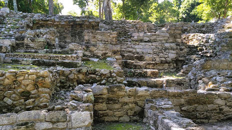
Photo
Where is located Archaeological Zone of Oxtankah
Archaeological Zone of Oxtankah — local attraction, which is located at Yucatán Norte, Q.R., Mexico and belongs to the category — archaeological museum. Average visitor rating for this place — 4.7 (according to 260 ratings, information from open sources and relevant for 2022).
Exact location — Archaeological Zone of Oxtankah, marked on the map with a red marker.
You can get directions to Archaeological Zone of Oxtankah on the map from your location.
What else is interesting in Chetumal? You can see all the sights if you go to the city page.
Coordinates
Archaeological Zone of Oxtankah, Mexico coordinates in decimal format: latitude — 18.60922023319595, longitude — -88.23323730258097. When converted to degrees, minutes, seconds Archaeological Zone of Oxtankah has the following coordinates: 18°36′33.19 north latitude and -88°13′59.65 east longitude.
Nearby cities
The largest cities that are located nearby:
- Campeche — 275 km
- Merida — 304 km
- Choloma
 (Honduras) — 323 km
 - Cancún — 330 km
- San Pedro Sula (Honduras) — 333 km
- La Ceiba (Honduras) — 340 km
- El Progreso (Honduras) — 347 km
- Ciudad del Carmen — 368 km
- San Juan Sacatepéquez
 (Guatemala) — 488 km
 - Guatemala City (Guatemala) — 492 km
- Villahermosa — 492 km
- San Cristóbal de las Casas — 499 km
- Tegucigalpa (Honduras) — 502 km
- Villa Nueva (Guatemala) — 503 km
- Villa Canales (Guatemala) — 504 km
- Santa Ana
 (El Salvador) — 518 km
 - Apopa (El Salvador) — 527 km
- Quetzaltenango (Guatemala) — 532 km
- Escuintla (Guatemala) — 536 km
Distance to the capital
Distance to the capital (Mexico City) is about — 1150 km.