
 Belém
Maranguape
Paranaguá
Paranaguá
Monte Alegre
Alvorada de Minas
Bragança
Laguna
Ibiporã
Belém
Maranguape
Paranaguá
Paranaguá
Monte Alegre
Alvorada de Minas
Bragança
Laguna
Ibiporã
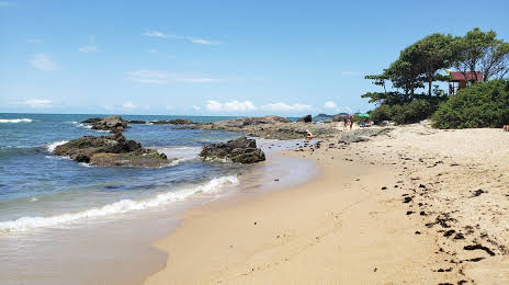
Praia da Bacia da Vovó on the map, Penha, Brazil
Photo
Where is located Praia da Bacia da Vovó
Praia da Bacia da Vovó — local attraction, which is located at no data and belongs to the category — -. Average visitor rating for this place — 4.6 (according to 3572 ratings, information from open sources and relevant for 2022).
Exact location — Praia da Bacia da Vovó, marked on the map with a red marker.
You can get directions to Praia da Bacia da Vovó on the map from your location.
What else is interesting in Penha? You can see all the sights if you go to the city page.
Coordinates
Praia da Bacia da Vovó, Brazil coordinates in decimal format: latitude — -26.761560314359382, longitude — -48.64657605407843. When converted to degrees, minutes, seconds Praia da Bacia da Vovó has the following coordinates: -26°45′41.62 north latitude and -48°38′47.67 east longitude.
Nearby cities
The largest cities that are located nearby:
- Itajaí — 15 km
- Blumenau — 45 km
- Jaraguá do Sul — 53 km
- Joinville — 56 km
- Florianópolis — 91 km
- São José — 93 km
- Palhoça — 96 km
- Paranaguá — 140 km
- São José dos Pinhais — 148 km
- Araucária — 152 km
- Pinhais — 157 km
- Curitiba — 161 km
- Colombo — 174 km
- Lages — 200 km
- Criciúma — 221 km
- Guarapuava — 320 km
- Itapetininga — 358 km
- Caxias do Sul — 360 km
- Praia Grande — 380 km