
 Bel-Ha
San Jose El Alto
El Porvenir
Nueva Palestina
Santa Lucía
Chemax
La Morita
Temoac
Zacualpan
Bel-Ha
San Jose El Alto
El Porvenir
Nueva Palestina
Santa Lucía
Chemax
La Morita
Temoac
Zacualpan
Fuente del Sol on the map, Zihuatanejo, Mexico
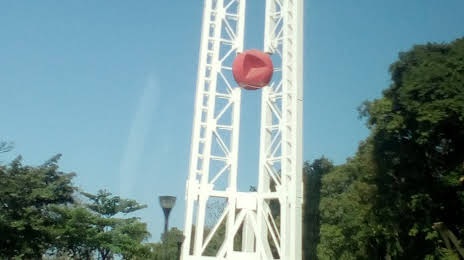
Photo
Where is located Fuente del Sol
Fuente del Sol — local attraction, which is located at Calle Paseo de Zihuatanejo Ote. 29-C, Centro, 40890 Zihuatanejo, Gro., Mexico and belongs to the category — tourist attraction. Average visitor rating for this place — 4.3 (according to 49 ratings, information from open sources and relevant for 2022).
Exact location — Fuente del Sol, marked on the map with a red marker.
You can get directions to Fuente del Sol on the map from your location.
What else is interesting in Zihuatanejo? You can see all the sights if you go to the city page.
Coordinates
Fuente del Sol, Mexico coordinates in decimal format: latitude — 17.650003068973184, longitude — -101.54640620275346. When converted to degrees, minutes, seconds Fuente del Sol has the following coordinates: 17°39′0.01 north latitude and -101°32′47.06 east longitude.
Nearby cities
The largest cities that are located nearby:
- Acapulco — 196 km
- Uruapan — 202 km
- Chilpancingo — 216 km
- Iguala — 225 km
- Morelia — 231 km
- Toluca — 268 km
- Zamora — 271 km
- Metepec — 271 km
- Cuernavaca — 282 km
- Jiutepec — 283 km
- Colima — 288 km
- Cuautla — 301 km
- Naucalpan — 316 km
- Ciudad López Mateos — 319 km
- Tlalnepantla — 323 km
- Salamanca — 325 km
- Cuautitlán Izcalli — 327 km
- Celaya — 328 km
- Buenavista — 329 km
Distance to the capital
Distance to the capital (Mexico City) is about — 323 km.