
 Litoral Del Bajo San Juan
El Cantón de San Pablo
Juan Frío
Santa Barbara
El Juncal
Dibulla
Vereda Campo Alegre
San Pablo
Guaramito
Litoral Del Bajo San Juan
El Cantón de San Pablo
Juan Frío
Santa Barbara
El Juncal
Dibulla
Vereda Campo Alegre
San Pablo
Guaramito
Parque Camellón Rodrigo de Bastidas on the map, Santa Marta, Colombia
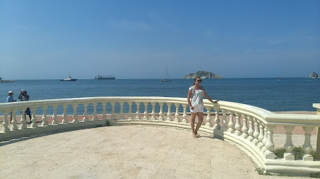
Photo
Where is located Parque Camellón Rodrigo de Bastidas
Parque Camellón Rodrigo de Bastidas — local attraction, which is located at Cl. 15 #1, Santa Marta, Magdalena, Colombia and belongs to the category — state park. Average visitor rating for this place — 4.4 (according to 1341 rating, information from open sources and relevant for 2022).
Exact location — Parque Camellón Rodrigo de Bastidas, marked on the map with a red marker.
You can get directions to Parque Camellón Rodrigo de Bastidas on the map from your location.
What else is interesting in Santa Marta? You can see all the sights if you go to the city page.
Coordinates
Parque Camellón Rodrigo de Bastidas, Colombia coordinates in decimal format: latitude — 11.245115577695863, longitude — -74.21461690282852. When converted to degrees, minutes, seconds Parque Camellón Rodrigo de Bastidas has the following coordinates: 11°14′42.42 north latitude and -74°12′52.62 east longitude.
Nearby cities
The largest cities that are located nearby:
- Barranquilla — 71 km
- Soledad — 71 km
- Malambo — 75 km
- Valledupar — 134 km
- Cartagena — 171 km
- Maicao — 214 km
- Magangué — 229 km
- Sincelejo — 251 km
- Maracaibo
 (Venezuela) — 287 km
 - Cabimas (Venezuela) — 312 km
- Monteria — 331 km
- Cúcuta — 415 km
- Setpoint (Venezuela) — 439 km
- Ejido (Venezuela) — 440 km
- San Cristobal (Venezuela) — 441 km
- Merida (Venezuela) — 444 km
- Barrancabermeja — 464 km
- Bucaramanga — 470 km
- Giron — 475 km
Distance to the capital
Distance to the capital (Bogota) is about — 739 km.