
 Belém
Maranguape
Paranaguá
Paranaguá
Monte Alegre
Alvorada de Minas
Bragança
Laguna
Ibiporã
Belém
Maranguape
Paranaguá
Paranaguá
Monte Alegre
Alvorada de Minas
Bragança
Laguna
Ibiporã
Igreja de Cristo Rei de Canindé Ceará on the map, Canindé, Brazil
Photo
Where is located Igreja de Cristo Rei de Canindé Ceará
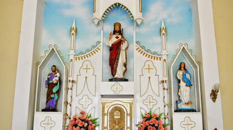
Igreja de Cristo Rei de Canindé Ceará — local attraction, which is located at Av. Chicó Campos, 22 - Centro, Canindé - CE, 62700-000, Brazil and belongs to the category — catholic church. Average visitor rating for this place — 4.7 (according to 313 ratings, information from open sources and relevant for 2022).
Exact location — Igreja de Cristo Rei de Canindé Ceará, marked on the map with a red marker.
You can get directions to Igreja de Cristo Rei de Canindé Ceará on the map from your location.
What else is interesting in Canindé? You can see all the sights if you go to the city page.
Coordinates
Igreja de Cristo Rei de Canindé Ceará, Brazil coordinates in decimal format: latitude — -4.362783385569645, longitude — -39.3206447028723. When converted to degrees, minutes, seconds Igreja de Cristo Rei de Canindé Ceará has the following coordinates: -4°21′46.02 north latitude and -39°19′14.32 east longitude.
Nearby cities
The largest cities that are located nearby:
- Maracanaú — 93 km
- Caucaia — 100 km
- Fortaleza — 111 km
- Mossoro — 235 km
- Parnaíba — 316 km
- Juazeiro do Norte — 317 km
- Teresina — 393 km
- Timon — 396 km
- Caxias — 449 km
- Parnamirim — 477 km
- Natal — 479 km
- Campina Grande — 493 km
- Santa Rita — 567 km
- Caruaru — 568 km
- Petrolina — 571 km
- João Pessoa — 578 km
- São Luís — 585 km
- Camaragibe — 624 km
- Jaboatão dos Guararapes — 633 km