
 Belém
Maranguape
Paranaguá
Paranaguá
Monte Alegre
Alvorada de Minas
Bragança
Laguna
Ibiporã
Belém
Maranguape
Paranaguá
Paranaguá
Monte Alegre
Alvorada de Minas
Bragança
Laguna
Ibiporã
National Forest Araripe-Apodi on the map, Barbalha, Brazil
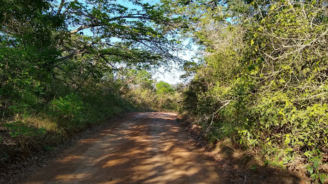
Photo
Where is located National Forest Araripe-Apodi
National Forest Araripe-Apodi — local attraction, which is located at CE-060, 13222, Barbalha - CE, 63180-000, Brazil and belongs to the category — national forest. Average visitor rating for this place — 4.8 (according to 724 ratings, information from open sources and relevant for 2022).
Exact location — National Forest Araripe-Apodi, marked on the map with a red marker.
You can get directions to National Forest Araripe-Apodi on the map from your location.
What else is interesting in Barbalha? You can see all the sights if you go to the city page.
Coordinates
National Forest Araripe-Apodi, Brazil coordinates in decimal format: latitude — -7.35999426743291, longitude — -39.420318161213494. When converted to degrees, minutes, seconds National Forest Araripe-Apodi has the following coordinates: -7°21′35.98 north latitude and -39°25′13.15 east longitude.
Nearby cities
The largest cities that are located nearby:
- Juazeiro do Norte — 8 km
- Petrolina — 266 km
- Mossoro — 318 km
- Campina Grande — 376 km
- Caruaru — 381 km
- Maracanaú — 387 km
- Arapiraca — 396 km
- Caucaia — 401 km
- Fortaleza — 404 km
- Teresina — 456 km
- Timon — 459 km
- Parnamirim — 469 km
- Maceió — 470 km
- Aracaju — 470 km
- Santa Rita — 476 km
- Camaragibe — 480 km
- Jaboatão dos Guararapes — 481 km
- Natal — 481 km
- João Pessoa — 489 km