
 Gilserberg
Berlin
Bordesholm
Bechtolsheim
Aub
Triptis
Heppenheim
Biblis
Angermünde
Gilserberg
Berlin
Bordesholm
Bechtolsheim
Aub
Triptis
Heppenheim
Biblis
Angermünde
LWL-Archäologie für Westfalen on the map, Münster, Germany
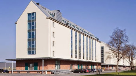
Photo
Where is located LWL-Archäologie für Westfalen
LWL-Archäologie für Westfalen — local attraction, which is located at An den Speichern 12, 48157 Münster, Germany and belongs to the category — museum. Average visitor rating for this place — 4.6 (according to 11 ratings, information from open sources and relevant for 2022).
Exact location — LWL-Archäologie für Westfalen, marked on the map with a red marker.
You can get directions to LWL-Archäologie für Westfalen on the map from your location.
What else is interesting in Münster? You can see all the sights if you go to the city page.
Coordinates
LWL-Archäologie für Westfalen, Germany coordinates in decimal format: latitude — 51.99969580631943, longitude — 7.634923798313087. When converted to degrees, minutes, seconds LWL-Archäologie für Westfalen has the following coordinates: 51°59′58.9 north latitude and 7°38′5.73 east longitude.
Nearby cities
The largest cities that are located nearby:
- Hamm — 34 km
- Osnabrück — 45 km
- Recklinghausen — 48 km
- Dortmund — 51 km
- Herne — 55 km
- Enschede
 (Netherlands) — 57 km
 - Bochum — 60 km
- Witten — 60 km
- Gelsenkirchen — 61 km
- Bielefeld — 62 km
- Hagen — 67 km
- Bottrop — 67 km
- Essen — 70 km
- Oberhausen — 73 km
- Mülheim — 79 km
- Paderborn — 82 km
- Duisburg — 83 km
- Wuppertal — 85 km
- Moers — 88 km
Distance to the capital
Distance to the capital (Berlin) is about — 397 km.