
 Józefów nad Wisłą
Gorzyce Wielkie
Rogówek
Sromowce Niżne
Wyszków County
Kruszewo
Jantar
Sady Górne
Nagoszewo
Józefów nad Wisłą
Gorzyce Wielkie
Rogówek
Sromowce Niżne
Wyszków County
Kruszewo
Jantar
Sady Górne
Nagoszewo
Fort Przyczółek Mostowy w Toruniu on the map, Torun, Poland
Photo
Where is located Fort Przyczółek Mostowy w Toruniu
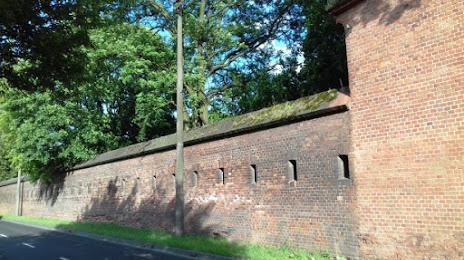
Fort Przyczółek Mostowy w Toruniu — local attraction, which is located at Podgórska 8, 87-100 Toruń, Poland and belongs to the category — fortress. Average visitor rating for this place — 4.1 (according to 12 ratings, information from open sources and relevant for 2022).
Exact location — Fort Przyczółek Mostowy w Toruniu, marked on the map with a red marker.
You can get directions to Fort Przyczółek Mostowy w Toruniu on the map from your location.
What else is interesting in Torun? You can see all the sights if you go to the city page.
Coordinates
Fort Przyczółek Mostowy w Toruniu, Poland coordinates in decimal format: latitude — 52.9994192956127, longitude — 18.614342748191934. When converted to degrees, minutes, seconds Fort Przyczółek Mostowy w Toruniu has the following coordinates: 52°59′57.91 north latitude and 18°36′51.63 east longitude.
Nearby cities
The largest cities that are located nearby:
- Bydgoszcz — 41 km
- Wloclawek — 51 km
- Plock — 91 km
- Poznań — 131 km
- Elblag — 137 km
- Kalisz — 142 km
- Gdańsk — 148 km
- Olsztyn — 149 km
- Łódź — 151 km
- Gdynia — 166 km
- Koszalin — 204 km
- Kaliningrad
 (Russia) — 225 km
 - Gorzów Wielkopolski — 227 km
- Wrocław — 237 km
- Zielona Gora — 242 km
- Częstochowa — 246 km
- Radom — 250 km
- Legnica — 262 km
- Opole — 263 km
Distance to the capital
Distance to the capital (Warsaw) is about — 183 km.