
 Gilserberg
Berlin
Bordesholm
Bechtolsheim
Aub
Triptis
Heppenheim
Biblis
Angermünde
Gilserberg
Berlin
Bordesholm
Bechtolsheim
Aub
Triptis
Heppenheim
Biblis
Angermünde
Augsburger Wassermanagement-System on the map, Augsburg, Germany
Photo
Where is located Augsburger Wassermanagement-System
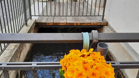
Augsburger Wassermanagement-System — local attraction, which is located at 86152 Augsburg, Germany and belongs to the category — museum. Average visitor rating for this place — 5.0 (according to 2 ratings, information from open sources and relevant for 2022).
Exact location — Augsburger Wassermanagement-System, marked on the map with a red marker.
You can get directions to Augsburger Wassermanagement-System on the map from your location.
What else is interesting in Augsburg? You can see all the sights if you go to the city page.
Coordinates
Augsburger Wassermanagement-System, Germany coordinates in decimal format: latitude — 48.371387143449944, longitude — 10.89032679802369. When converted to degrees, minutes, seconds Augsburger Wassermanagement-System has the following coordinates: 48°22′16.99 north latitude and 10°53′25.18 east longitude.
Nearby cities
The largest cities that are located nearby:
- Munich — 57 km
- Ingolstadt — 58 km
- Ulm — 67 km
- Regensburg — 113 km
- Nuremberg — 120 km
- Fürth — 123 km
- Reutlingen — 125 km
- Innsbruck
 (Austria) — 128 km
 - Stuttgart — 133 km
- Erlangen — 135 km
- Heilbronn — 149 km
- Pforzheim — 170 km
- Würzburg — 171 km
- Salzburg (Austria) — 172 km
- Karlsruhe — 194 km
- Heidelberg — 196 km
- Zurich
 (Switzerland) — 208 km
 - Mannheim — 214 km
- Ludwigshafen — 215 km
Distance to the capital
Distance to the capital (Berlin) is about — 495 km.