
 Brakel
Halberg
Rheinau
Flintbek
Klingenberg am Main
Markkleeberg
Miltenberg
Schwalbach am Taunus
Ladenburg
Bamberg
Raunheim
Lachendorf
Mammendorf
Zorneding
Reichenbach im Vogtland
Garching
Lohmar
Schwanheim
Flugplatz Dessau
Brakel
Halberg
Rheinau
Flintbek
Klingenberg am Main
Markkleeberg
Miltenberg
Schwalbach am Taunus
Ladenburg
Bamberg
Raunheim
Lachendorf
Mammendorf
Zorneding
Reichenbach im Vogtland
Garching
Lohmar
Schwanheim
Flugplatz Dessau
Röthenbach an der Pegnitz on the map, Germany
Where is located Röthenbach an der Pegnitz
Exact location — Röthenbach an der Pegnitz, Middle Franconia, Bavaria, Germany, marked on the map with a red marker.
Coordinates
Röthenbach an der Pegnitz, Germany coordinates in decimal format: latitude — 49.4815486, longitude — 11.2418751. When converted to degrees, minutes, seconds Röthenbach an der Pegnitz has the following coordinates: 49°28′53.57 north latitude and 11°14′30.75 east longitude.
Population
Röthenbach an der Pegnitz, Middle Franconia, Bavaria, Germany, according to our data the population is — 12,224 residents, which is about 0% of the total population of the country (Germany).
Comparison of the population on the graph:
Exact time
Time zone for this location Röthenbach an der Pegnitz — UTC +2 Europe/Berlin. Exact time — monday, 5 may 2024 year, 09 h. 26 minutes.
Sunrise and sunset
Röthenbach an der Pegnitz, sunrise and sunset data for a date — monday 13.05.2024.
| Sunrise | Sunset | Day (duration) |
|---|---|---|
| 05:36 -2 minutes | 20:45 +1 minute | 15 h. 12 minutes. +3 minutes |
You can control the scale of the map using the auxiliary tools to find out exactly where it is located Röthenbach an der Pegnitz. When you change the scale of the map, the width of the ruler also changes (in kilometers and miles).
Nearby cities
The largest cities that are located nearby:
- Nuremberg — 12 km
- Fürth — 18 km
- Erlangen — 20 km
- Ingolstadt — 80 km
- Regensburg — 81 km
- Würzburg — 98 km
- Augsburg — 125 km
- Ulm — 151 km
- Munich — 151 km
- Heilbronn — 152 km
- Pilsen
 (Czech Republic) — 155 km
 - Gera — 166 km
- Erfurt — 167 km
- Stuttgart — 169 km
- Reutlingen — 184 km
- Heidelberg — 185 km
- Offenbach — 188 km
- Chemnitz — 190 km
- Darmstadt — 190 km
Distance to neighboring capitals:
- Prague (Czech Republic) — 239 km
- Vaduz
 (Liechtenstein) — 290 km
 - Bern
 (Switzerland) — 398 km
 - Vienna
 (Austria) — 401 km
 - Ljubljana
 (Slovenia) — 452 km
 - Brussels
 (Belgium) — 514 km
 - Amsterdam
 (Netherlands) — 549 km
 - Paris
 (France) — 650 km
 - Paris (France) — 650 km
- Copenhagen
 (Denmark) — 695 km
 - Warsaw
 (Poland) — 750 km
 - Rome
 (Italy) — 849 km
 - Oslo
 (Norway) — 1161 km
 - Stockholm
 (Sweden) — 1174 km
 - Minsk
 (Belarus) — 1224 km
 - Kyiv
 (Ukraine) — 1380 km
 - Helsinki
 (Finland) — 1472 km
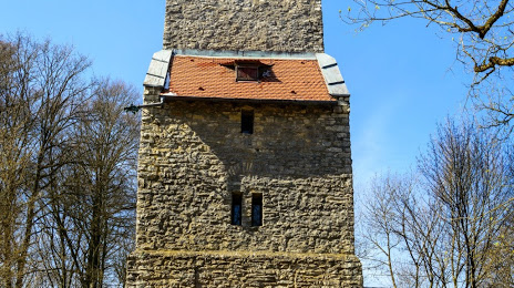
Attractions

Distance to the capital
Distance to the capital (Berlin) is about — 370 km.