
 Gilserberg
Berlin
Bordesholm
Bechtolsheim
Aub
Triptis
Heppenheim
Biblis
Angermünde
Gilserberg
Berlin
Bordesholm
Bechtolsheim
Aub
Triptis
Heppenheim
Biblis
Angermünde
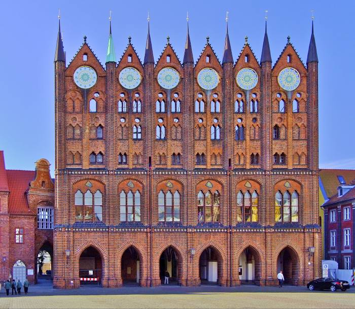
Rathaus Stralsund (Rathaus der Hansestadt Stralsund) on the map, Stralsund, Germany
Photo
Where is located Rathaus Stralsund (Rathaus der Hansestadt Stralsund)
Rathaus Stralsund (Rathaus der Hansestadt Stralsund) — local attraction, which is located at Alter Markt, 18439 Stralsund, Germany and belongs to the category — city or town hall. Average visitor rating for this place — 4.7 (according to 128 ratings, information from open sources and relevant for 2022).
Exact location — Rathaus Stralsund (Rathaus der Hansestadt Stralsund), marked on the map with a red marker.
You can get directions to Rathaus Stralsund (Rathaus der Hansestadt Stralsund) on the map from your location.
What else is interesting in Stralsund? You can see all the sights if you go to the city page.
Coordinates
Rathaus Stralsund (Rathaus der Hansestadt Stralsund), Germany coordinates in decimal format: latitude — 54.315643888511765, longitude — 13.09071209824173. When converted to degrees, minutes, seconds Rathaus Stralsund (Rathaus der Hansestadt Stralsund) has the following coordinates: 54°18′56.32 north latitude and 13°5′26.56 east longitude.
Nearby cities
The largest cities that are located nearby:
- Rostock — 68 km
- Szczecin
 (Poland) — 138 km
 - Malmö
 (Sweden) — 143 km
 - Copenhagen
 (Denmark) — 154 km
 - Kiel — 191 km
- Koszalin (Poland) — 201 km
- Berlin — 201 km
- Odense (Denmark) — 207 km
- Potsdam — 212 km
- Gorzów Wielkopolski (Poland) — 226 km
- Wolfsburg — 260 km
- Magdeburg — 261 km
- Aarhus (Denmark) — 271 km
- Brunswick — 284 km
- Cottbus — 295 km
- Salzgitter — 303 km
- Bremerhaven — 307 km
- Zielona Gora (Poland) — 310 km
- Hanover — 311 km
Distance to the capital
Distance to the capital (Berlin) is about — 201 km.