
 Józefów nad Wisłą
Gorzyce Wielkie
Rogówek
Sromowce Niżne
Wyszków County
Kruszewo
Jantar
Sady Górne
Nagoszewo
Józefów nad Wisłą
Gorzyce Wielkie
Rogówek
Sromowce Niżne
Wyszków County
Kruszewo
Jantar
Sady Górne
Nagoszewo
Wigry National Park (Wigierski Park Narodowy) on the map, Suwalki, Poland
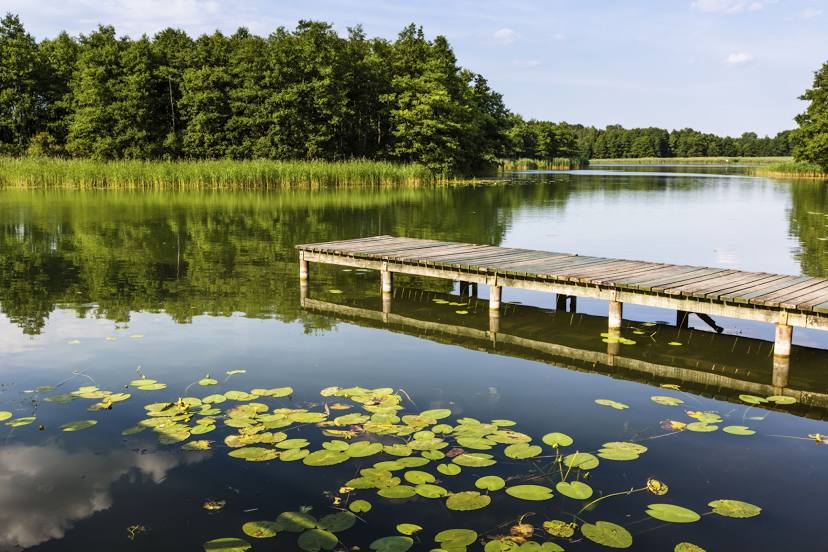
Photo
Where is located Wigry National Park (Wigierski Park Narodowy)
Wigry National Park (Wigierski Park Narodowy) — local attraction, which is located at Krzywe 82, 16-402, Poland and belongs to the category — national park. Average visitor rating for this place — 4.7 (according to 3326 ratings, information from open sources and relevant for 2022).
Exact location — Wigry National Park (Wigierski Park Narodowy), marked on the map with a red marker.
You can get directions to Wigry National Park (Wigierski Park Narodowy) on the map from your location.
What else is interesting in Suwalki? You can see all the sights if you go to the city page.
Coordinates
Wigry National Park (Wigierski Park Narodowy), Poland coordinates in decimal format: latitude — 54.053820229273626, longitude — 23.114005454374148. When converted to degrees, minutes, seconds Wigry National Park (Wigierski Park Narodowy) has the following coordinates: 54°3′13.75 north latitude and 23°6′50.42 east longitude.
Nearby cities
The largest cities that are located nearby:
- Kaunas
 (Lithuania) — 107 km
 - Bialystok — 109 km
- Vilnius (Lithuania) — 163 km
- Olsztyn — 164 km
- Kaliningrad
 (Russia) — 168 km
 - Panevėžys (Lithuania) — 200 km
- Šiauliai (Lithuania) — 203 km
- Klaipėda (Lithuania) — 208 km
- Elblag — 228 km
- Brest
 (Belarus) — 229 km
 - Baranovichi (Belarus) — 232 km
- Maladzyechna (Belarus) — 254 km
- Gdańsk — 277 km
- Plock — 277 km
- Gdynia — 286 km
- Daugavpils
 (Latvia) — 297 km
 - Minsk (Belarus) — 303 km
- Wloclawek — 305 km
- Pinsk (Belarus) — 306 km
Distance to the capital
Distance to the capital (Warsaw) is about — 247 km.