
 Gilserberg
Berlin
Bordesholm
Bechtolsheim
Aub
Triptis
Heppenheim
Biblis
Angermünde
Gilserberg
Berlin
Bordesholm
Bechtolsheim
Aub
Triptis
Heppenheim
Biblis
Angermünde
Moor- und Bauernmuseum on the map, Wardenburg, Germany
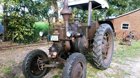
Photo
Where is located Moor- und Bauernmuseum
Moor- und Bauernmuseum — local attraction, which is located at Zu den Birken 15, 26203 Wardenburg, Germany and belongs to the category — museum. Average visitor rating for this place — 4.4 (according to 78 ratings, information from open sources and relevant for 2022).
Exact location — Moor- und Bauernmuseum, marked on the map with a red marker.
You can get directions to Moor- und Bauernmuseum on the map from your location.
What else is interesting in Wardenburg? You can see all the sights if you go to the city page.
Coordinates
Moor- und Bauernmuseum, Germany coordinates in decimal format: latitude — 53.04887773261634, longitude — 8.129279998193795. When converted to degrees, minutes, seconds Moor- und Bauernmuseum has the following coordinates: 53°2′55.96 north latitude and 8°7′45.41 east longitude.
Nearby cities
The largest cities that are located nearby:
- Bremen — 40 km
- Bremerhaven — 59 km
- Osnabrück — 87 km
- Emmen
 (Netherlands) — 92 km
 - Groningen (Netherlands) — 110 km
- Bielefeld — 116 km
- Münster — 127 km
- Enschede (Netherlands) — 128 km
- Hanover — 128 km
- Paderborn — 153 km
- Zwolle (Netherlands) — 154 km
- Hamm — 155 km
- Hildesheim — 156 km
- Recklinghausen — 174 km
- Salzgitter — 176 km
- Apeldoorn (Netherlands) — 178 km
- Dortmund — 178 km
- Brunswick — 180 km
- Herne — 182 km
Distance to the capital
Distance to the capital (Berlin) is about — 360 km.