
 Gilserberg
Berlin
Bordesholm
Bechtolsheim
Aub
Triptis
Heppenheim
Biblis
Angermünde
Gilserberg
Berlin
Bordesholm
Bechtolsheim
Aub
Triptis
Heppenheim
Biblis
Angermünde
Deutsche Raumfahrtausstellung Morgenröthe-Rautenkranz on the map, Auerbach, Germany
Photo
Where is located Deutsche Raumfahrtausstellung Morgenröthe-Rautenkranz
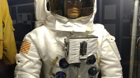
Deutsche Raumfahrtausstellung Morgenröthe-Rautenkranz — local attraction, which is located at Dr.-Sigmund-Jähn-Str. 4, 08262 Muldenhammer, Germany and belongs to the category — museum of space history. Average visitor rating for this place — 4.6 (according to 1476 ratings, information from open sources and relevant for 2022).
Exact location — Deutsche Raumfahrtausstellung Morgenröthe-Rautenkranz, marked on the map with a red marker.
You can get directions to Deutsche Raumfahrtausstellung Morgenröthe-Rautenkranz on the map from your location.
What else is interesting in Auerbach? You can see all the sights if you go to the city page.
Coordinates
Deutsche Raumfahrtausstellung Morgenröthe-Rautenkranz, Germany coordinates in decimal format: latitude — 50.46140042971676, longitude — 12.492069398098335. When converted to degrees, minutes, seconds Deutsche Raumfahrtausstellung Morgenröthe-Rautenkranz has the following coordinates: 50°27′41.04 north latitude and 12°29′31.45 east longitude.
Nearby cities
The largest cities that are located nearby:
- Gera — 47 km
- Chemnitz — 51 km
- Leipzig — 92 km
- Erfurt — 109 km
- Pilsen
 (Czech Republic) — 110 km
 - Dresden — 111 km
- Erlangen — 142 km
- Nuremberg — 151 km
- Prague (Czech Republic) — 152 km
- Fürth — 152 km
- Regensburg — 167 km
- Magdeburg — 186 km
- Cottbus — 191 km
- Würzburg — 192 km
- Ingolstadt — 205 km
- Göttingen — 205 km
- Potsdam — 213 km
- Kassel — 220 km
- Salzgitter — 229 km
Distance to the capital
Distance to the capital (Berlin) is about — 238 km.