
 Puerto de la Duquesa
La Serna de Iguña
Pumalverde
Puentenansa
La Iglesia
Casar de Periedo
Fuengirola
Renedo de Piélagos
Villabanez
Puerto de la Duquesa
La Serna de Iguña
Pumalverde
Puentenansa
La Iglesia
Casar de Periedo
Fuengirola
Renedo de Piélagos
Villabanez
La Casa del Rey Moro on the map, Ronda, Spain
Photo
Where is located La Casa del Rey Moro
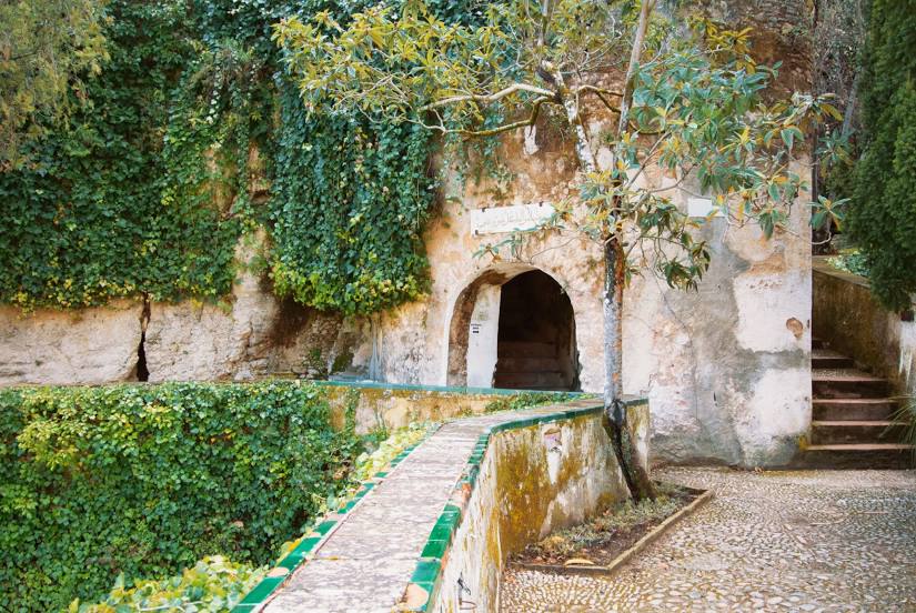
La Casa del Rey Moro — local attraction, which is located at C. Cta. de Santo Domingo, 9, 29400 Ronda, Málaga, Spain and belongs to the category — heritage museum. Average visitor rating for this place — 4.1 (according to 1086 ratings, information from open sources and relevant for 2022).
Exact location — La Casa del Rey Moro, marked on the map with a red marker.
You can get directions to La Casa del Rey Moro on the map from your location.
What else is interesting in Ronda? You can see all the sights if you go to the city page.
Coordinates
La Casa del Rey Moro, Spain coordinates in decimal format: latitude — 36.739790891651474, longitude — -5.164319902345305. When converted to degrees, minutes, seconds La Casa del Rey Moro has the following coordinates: 36°44′23.25 north latitude and -5°9′51.55 east longitude.
Nearby cities
The largest cities that are located nearby:
- Marbella — 36 km
- Málaga — 61 km
- Algeciras — 72 km
- Jerez — 86 km
- Dos Hermanas — 90 km
- Cádiz — 103 km
- Tangier
 (Morocco) — 125 km
 - Córdoba — 131 km
- Tetouan (Morocco) — 132 km
- Granada — 146 km
- Jaén — 166 km
- Huelva — 167 km
- Almería — 239 km
- Taounate (Morocco) — 249 km
- Nador (Morocco) — 267 km
- Badajoz — 283 km
- Taza (Morocco) — 299 km
- Kenitra (Morocco) — 305 km
- Meknes (Morocco) — 317 km
Distance to the capital
Distance to the capital (Madrid) is about — 428 km.